
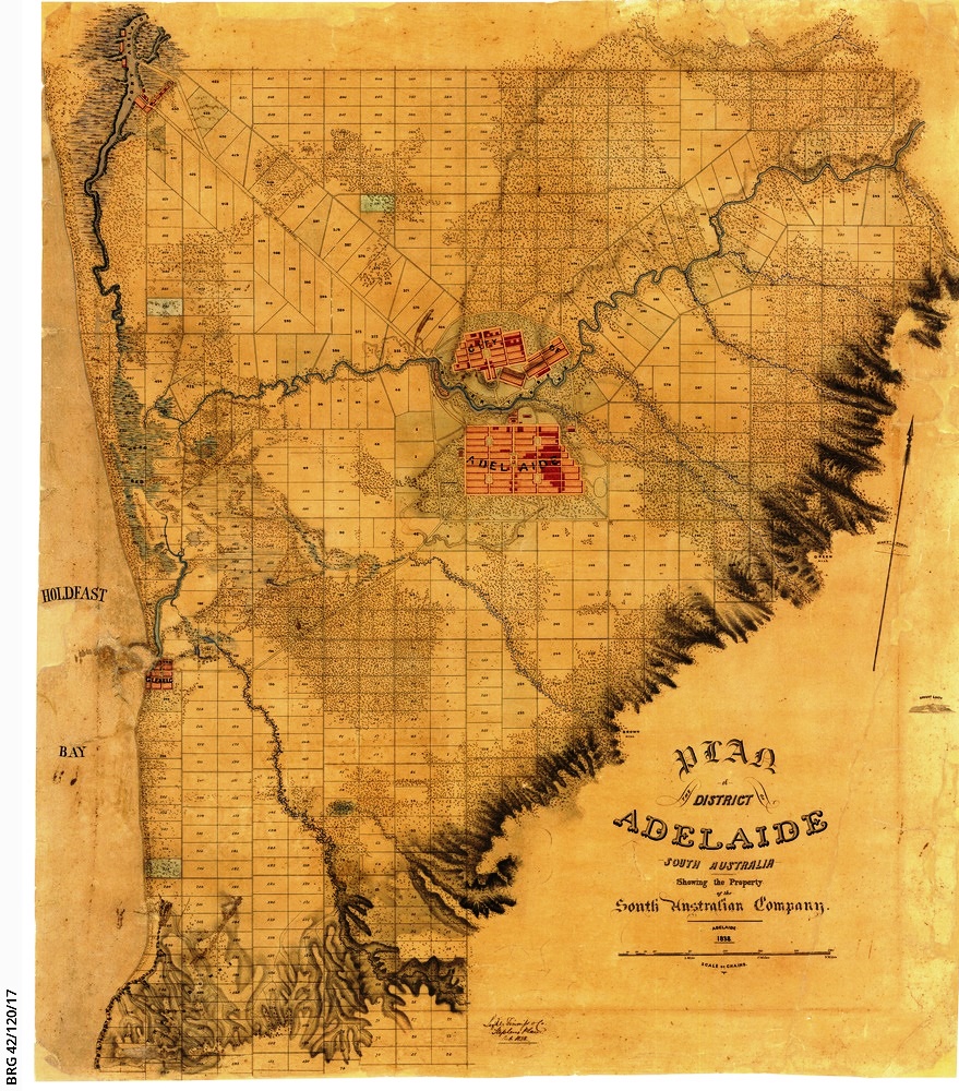
Image: 1838 map of Adelaide BRG-42-120-17
Size of this preview: 527 × 600 pixels. Other resolutions: 211 × 240 pixels | 879 × 1,000 pixels.
Original image (879 × 1,000 pixels, file size: 506 KB, MIME type: image/jpeg)
Description: Includes Adelaide city centre, North Adelaide and surrounding parklands; Port Adelaide, Holdfast Bay and Glenelg down to the area just south of Marino; the rivers of the Adelaide plains and Port River; and the foothills of the Mount Lofty Ranges. Based on the survey by Light, Finniss & Co., with the date October 1838. From the London office of the South Australian Company; appears to predate the maps of the same area published in London by John Arrowsmith.
Author: Unknown
Usage Terms: Creative Commons Attribution-Share Alike 3.0
License: CC-BY-SA-3.0
License Link: http://creativecommons.org/licenses/by-sa/3.0/
Attribution Required?: Yes
Image usage
The following page links to this image:

All content from Kiddle encyclopedia articles (including the article images and facts) can be freely used under Attribution-ShareAlike license, unless stated otherwise.