
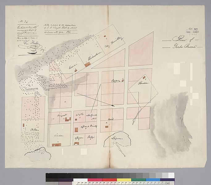
Image: 1839 Plan of Yerba Buena (Jean Jacques Vioget)

Size of this preview: 683 × 600 pixels. Other resolutions: 273 × 240 pixels | 2,400 × 2,107 pixels.
Original image (2,400 × 2,107 pixels, file size: 727 KB, MIME type: image/jpeg)
Description: Plan of Yerba Buena (which was later renamed to San Francisco), as laid out by Jean Jacques Vioget. The map itself dates to 1839, but was published in 1853 as part of a deposition; oriented with north to the right and centered on Portsmouth Square; bounded on the right (north) by Pacific, on the left (south) by Washington), on the top (west) by Grant, and on the bottom (east) by Montgomery.
Title: 1839 Plan of Yerba Buena (Jean Jacques Vioget)
Credit: http://content.cdlib.org/ark:/13030/hb70000713/?order=1
Author: Jean Jacques Vioget
Usage Terms: Public domain
License: Public domain
Attribution Required?: No
Image usage
The following 2 pages link to this image:

All content from Kiddle encyclopedia articles (including the article images and facts) can be freely used under Attribution-ShareAlike license, unless stated otherwise.
.jpg)