
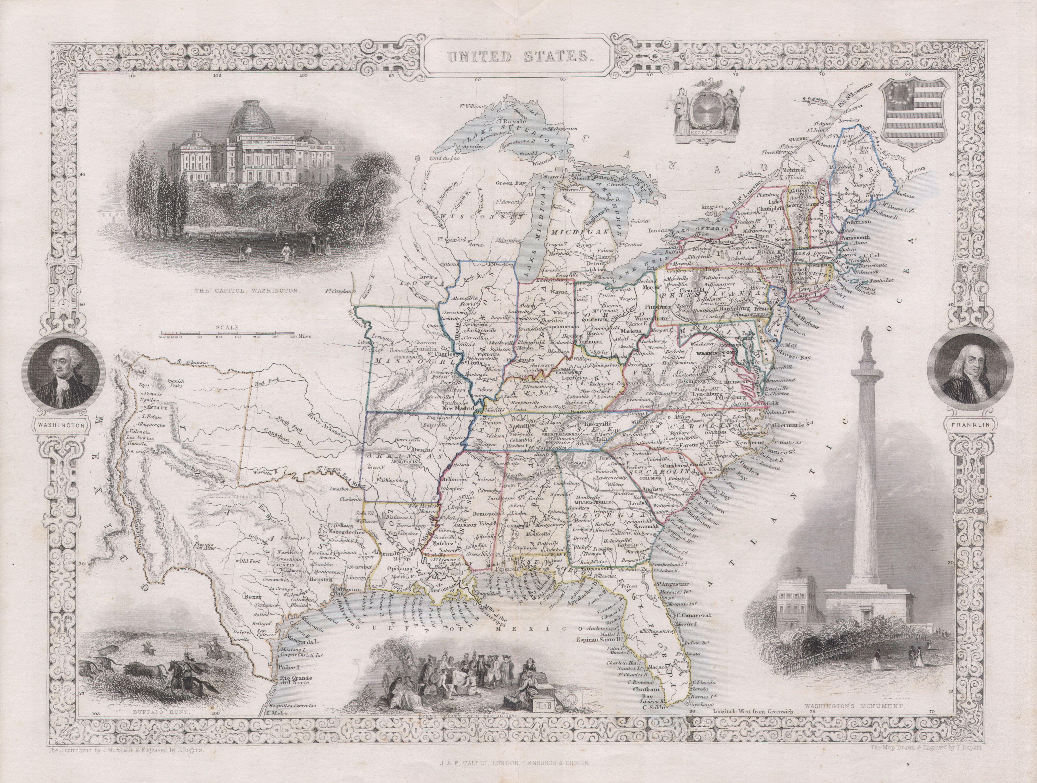
Image: 1850 Tallis Map of the United States ( Texas at fullest extent) - Geographicus - UnitedStates-tallis-1850
Description: This is John Tallis’s highly desirable 1850 Map of the United States. This is the earliest variation on this map that includes Texas as a state. Herein Texas is depicted at near its fullest extent including both Santa Fe and but excluding the Green Mountain extension in the Northwest. Wisconsin and Iowa are shown with amorphous boundaries. Offers several beautiful vignettes depicting the Baltimore Washington Monument, The Capitol in Washington D.C., Penn’s Treaty with the Indians, and an American Indian Buffalo Hunt on the Great Plains. The upper right quadrant features a U.S. flag shield and an Excelsior seal. The ornate border includes the portraits of Washington and Franklin. Undated, but the form of Texas allows us to positively date this to the early 1850 issue of Tallis’s valuable map.
Title: United States.
Credit: This file was provided to Wikimedia Commons by Geographicus Rare Antique Maps, a specialist dealer in rare maps and other cartography of the 15th, 16th, 17th, 18th and 19th centuries, as part of a cooperation project.
Author: http://www.geographicus.com/mm5/cartographers/tallis.txt
Permission: This image might not be in the public domain outside of the United States; this especially applies in the countries and areas that do not apply the rule of the shorter term for US works, such as Canada, Mainland China (not Hong Kong or Macao), Germany, Mexico, and Switzerland. The creator and year of publication are essential information and must be provided. See Wikipedia:Public domain and Wikipedia:Copyrights for more details.
Usage Terms: Public domain
License: Public domain
Attribution Required?: No
Image usage
The following page links to this image:

_-_Geographicus_-_UnitedStates-tallis-1850.jpg)