
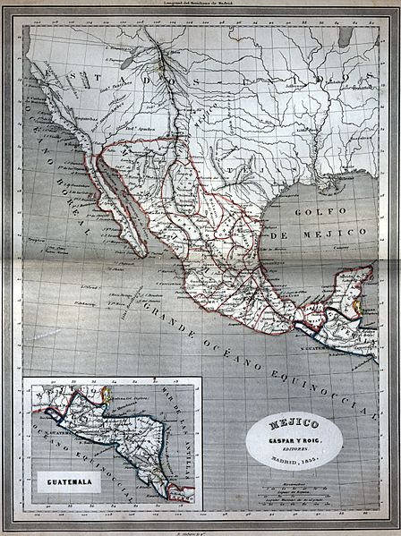
Image: 1853 Map of Mexico Gaspar y Roig

Size of this preview: 448 × 599 pixels. Other resolutions: 179 × 240 pixels | 2,523 × 3,374 pixels.
Original image (2,523 × 3,374 pixels, file size: 12.3 MB, MIME type: image/jpeg)
Description: An 1853 map of Mexico (Mejico) from a Spanish atlas, showing the independent state of Soconusco between Mexico and Guatemala
Title: 1853 Map of Mexico Gaspar y Roig
Credit: My own framed copy of 1853 map of Mexico, uploaded to FlickR here https://www.flickr.com/photos/ken_mayer/4558220916/
Author: Gaspar y Roig
Usage Terms: Public domain
License: Public domain
Attribution Required?: No
Image usage
The following page links to this image:

All content from Kiddle encyclopedia articles (including the article images and facts) can be freely used under Attribution-ShareAlike license, unless stated otherwise.