
Image: 1875 Kaskaskia with present day satellite imagery
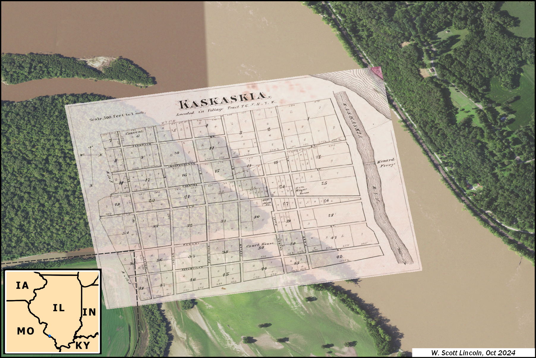
Description: 1875 map of Kaskaskia, Illinois, overlaid upon satellite imagery from 2019. Most of the original town town site of Kaskaskia is now covered by the Mississippi River, including the location of the first Illinois state house. Map of Kaskaskia from the Historical Atlas Map of Randolph County, Illinois, published by W.R. Brink & Company in 1875, archived by the US Library of Congress. Aerial imagery collected by National Agriculture Imagery Program in 2019 and retrieved from the US Geological Survey.
Title: 1875 Kaskaskia with present day satellite imagery
Credit: Own work
Author: Slincoln
Usage Terms: Creative Commons Attribution-Share Alike 4.0
License: CC BY-SA 4.0
License Link: https://creativecommons.org/licenses/by-sa/4.0
Attribution Required?: Yes
Image usage
The following page links to this image:
