
Image: 1876 Montgomery and West Point RR map
No higher resolution available.
1876_Montgomery_and_West_Point_RR_map.jpg (403 × 207 pixels, file size: 77 KB, MIME type: image/jpeg)
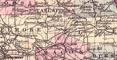
Description: Map detail shows the Montgomery and West Point Railroad in 1876. This map was cropped from "File:1876 Map of Alabama counties.jpeg".
Title: 1876 Montgomery and West Point RR map
Credit: Own work
Author: Djmaschek
Usage Terms: Creative Commons Attribution-Share Alike 4.0
License: CC BY-SA 4.0
License Link: https://creativecommons.org/licenses/by-sa/4.0
Attribution Required?: Yes
Image usage
The following 2 pages link to this image:

All content from Kiddle encyclopedia articles (including the article images and facts) can be freely used under Attribution-ShareAlike license, unless stated otherwise.