
Image: 1884 map

Size of this preview: 393 × 599 pixels. Other resolutions: 157 × 240 pixels | 2,699 × 4,111 pixels.
Original image (2,699 × 4,111 pixels, file size: 2.94 MB, MIME type: image/jpeg)
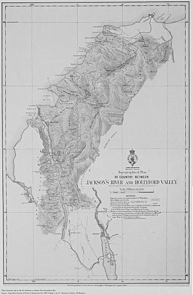
Description: Map of the proposed road to link the settlements of Martins Bay and Jacksons Bay.
Title: 1884 map
Credit: Orig source (see bottom of image): Appendices Journal of House of Representatives 1884 Volume 1 pp. 74. (National Archives, Wellington). Photolithographed at the Gernal Survey Office, Wellington, N.Z. August 1884. scanned(?) by Piopiotahi.
Author: Unknown authorUnknown author
Usage Terms: Public domain
License: Public domain
Attribution Required?: No
Image usage
The following page links to this image:

All content from Kiddle encyclopedia articles (including the article images and facts) can be freely used under Attribution-ShareAlike license, unless stated otherwise.