
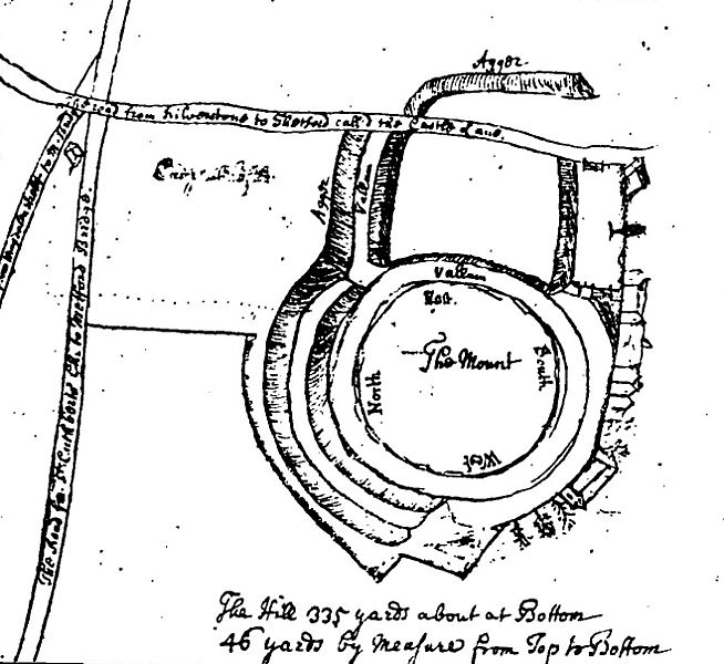
Image: 18th century map of Thetford Castle

Size of this preview: 654 × 600 pixels. Other resolutions: 262 × 240 pixels | 1,318 × 1,209 pixels.
Original image (1,318 × 1,209 pixels, file size: 345 KB, MIME type: image/jpeg)
Description: Sketch of Thetford Castle, around 1740
Title: 18th century map of Thetford Castle
Credit: Reproduced in article by W. G. Clarke, Norfolk Archaeology, 1907
Author: Tom Martin, 18th century
Usage Terms: Public domain
License: Public domain
Attribution Required?: No
Image usage
The following page links to this image:

All content from Kiddle encyclopedia articles (including the article images and facts) can be freely used under Attribution-ShareAlike license, unless stated otherwise.