
Image: 1904 view of eastern Hamilton Harbour and Paget Parish from Fort Hamilton, Prospect Camp, Bermuda

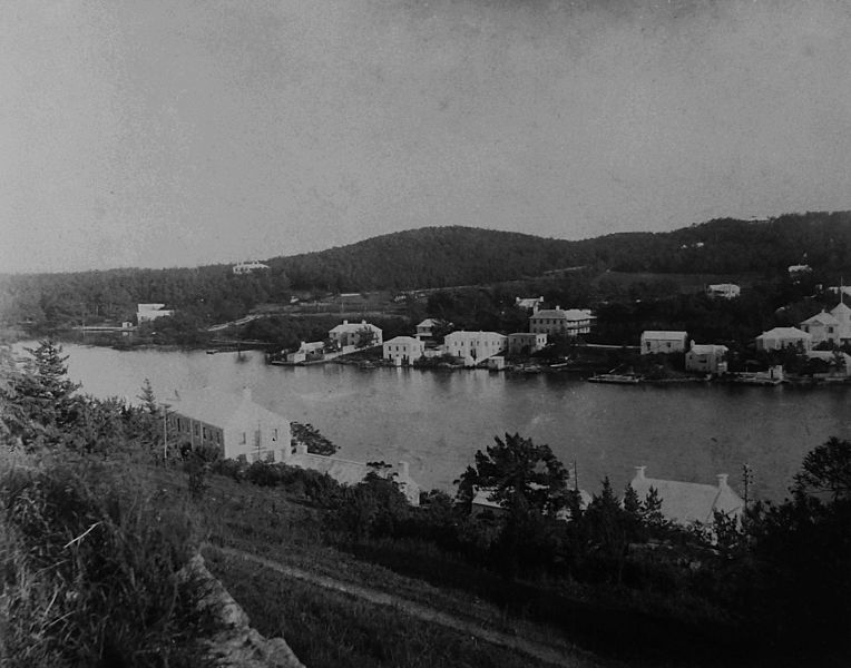
Description: 1904 view of eastern Hamilton Harbour and Paget Parish from Fort Hamilton, Prospect Camp, en:Bermuda (the fort is located in Pembroke Parish, though most of Prospect Camp is within Devonshire Parish). The East Broadway road is hidden at the foot of the slope below the fort, on the northern shore of the harbour. The roof of the house at centre on the northern shore belonged to the landmark "Queen of The East", allowed to become derelict by its owners, despite being a listed property, and demolished in 2016 to make way for a new development. On the opposing southern shore of the harbour, a number of houses are shown on Pomander Road, most of which still exist, with the notable exception being the large building on the landward side of the road at centre, which was the "Pomander Gate" guesthouse. Its site is now occupied by a new build housing development and a tennis club of the same name. Four decades before The Blight,[1][2][3][4][5] the Bermuda cedar cloaked ridgeline in the background includes the highpoint known as "Trimingham Hill" where Princess Louise occupied a private residence during the winter of 1883.
Title: 1904 view of eastern Hamilton Harbour and Paget Parish from Fort Hamilton, Prospect Camp, Bermuda
Credit: Copied from original photographic print in an album of the 3rd Battalion, The Royal Fusiliers (City of London Regiment), currently held by the Bermuda Archives.
Author: British Army
Usage Terms: Public domain
License: Public domain
Attribution Required?: No
Image usage
The following 2 pages link to this image:
