
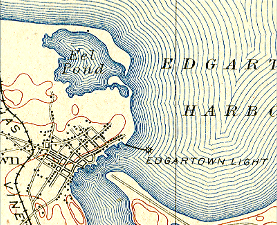
Image: 1908* Edgartown Light area USGS Topo Map
Description: 1908 United States Geological Service (USGS) topographic map depicting the Edgartown Light and surrounding vicinity. The map clearly illustrates Edgartown Light as being surrounded by water and connected to a point of land via the stone causeway first constructed in 1847. Located to the northeast of Edgartown Light is Eel Pond as it existed in 1908 with its massive barrier beach. A series of hurricanes in the 1950s destroyed the Eel Pond barrier beach. The destabilized Eel Pond sands were carried by the prevailing southeasterly littoral drift toward Edgartown Light. Due to oceanic current and tidal influences, a large volume of these sands were deposited in the location surrounding the Edgartown Light. This configuration of beach surrounding the Edgartown Light continues to exist today, even though it has slowly experienced erosion since the 1950s.
Title: 1908* Edgartown Light area USGS Topo Map
Credit: United States Geological Service
Author: William Waterway
Usage Terms: Public domain
License: Public domain
Attribution Required?: No
Image usage
The following page links to this image:
