
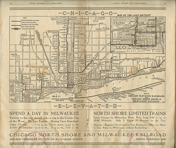
Image: 1921 Chicago L map

Size of this preview: 712 × 599 pixels. Other resolutions: 285 × 240 pixels | 3,029 × 2,550 pixels.
Original image (3,029 × 2,550 pixels, file size: 5.7 MB, MIME type: image/jpeg)
Description: Map found in a Chicago guidebook called "This Week in Chicago" dated Sept. 4–Sept. 10, 1921—carries the notations "Rand McNally & Co." and "7-'21."
Title: 1921 Chicago L map
Credit: "This Week in Chicago" Sept. 4–Sept. 10, 1921. Originally uploaded to en.wikipedia by w:User:Edzotti
Permission: Public Domain
Usage Terms: Public domain
License: Public domain
Attribution Required?: No
Image usage
The following page links to this image:

All content from Kiddle encyclopedia articles (including the article images and facts) can be freely used under Attribution-ShareAlike license, unless stated otherwise.