
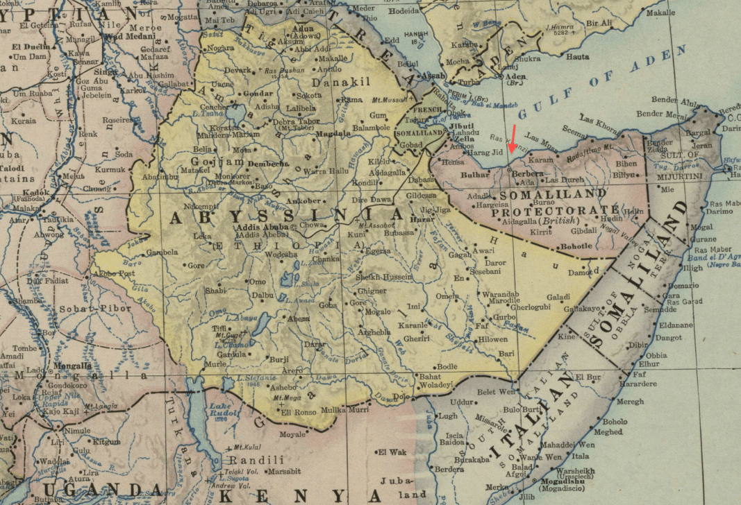
Image: 1922 Berbera detail Map of Africa and Adjoining Portions of Europe and Asia by US National Geographic Society BPL m0612013
Size of this preview: 800 × 546 pixels. Other resolutions: 320 × 218 pixels | 1,067 × 728 pixels.
Original image (1,067 × 728 pixels, file size: 636 KB, MIME type: image/png)
Description: Detail of: Map of Africa and Adjoining Portions of Europe and Asia Author: National Geographic Society (U.S.) Publisher: National Geographic Society (U.S.) Date: 1922 Scale: 1:11,500,000
Title: 1922 Berbera detail Map of Africa and Adjoining Portions of Europe and Asia by US National Geographic Society BPL m0612013
Credit: Boston Public Library, Map Center (Boston, Massachusetts, USA) / http://maps.bpl.org/id/m0612013
Author: National Geographic Society (U.S.)
Usage Terms: Public domain
License: Public domain
Attribution Required?: No
Image usage
The following page links to this image:

All content from Kiddle encyclopedia articles (including the article images and facts) can be freely used under Attribution-ShareAlike license, unless stated otherwise.