
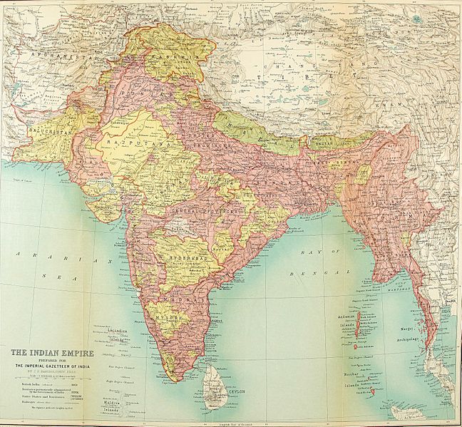
Image: 1922 Map of India by Bartholomew in Imperial Gazetteer of India

Size of this preview: 648 × 599 pixels. Other resolutions: 260 × 240 pixels | 3,729 × 3,449 pixels.
Original image (3,729 × 3,449 pixels, file size: 4.79 MB, MIME type: image/jpeg)
Description: British India map by J. G. Bartholomew Imperial Gazetteer of India (Oxford, Clarendon Press) A series of South Asia maps were published over 1908-1931 A list of other maps of India are available at the following link: http://www.columbia.edu/itc/mealac/pritchett/00maplinks/modern/bartholomew1922/bartholomew1922.html This map was published in 1922 License qualifies under PD-Art Archived by University of Chicago
Title: 1922 Map of India by Bartholomew in Imperial Gazetteer of India
Credit: http://dsal.uchicago.edu/maps/gazetteer/images/gazetteer_frontcover.jpg
Author: J. G. Bartholomew
Usage Terms: Public domain
License: Public domain
Attribution Required?: No
Image usage
The following page links to this image:

All content from Kiddle encyclopedia articles (including the article images and facts) can be freely used under Attribution-ShareAlike license, unless stated otherwise.