
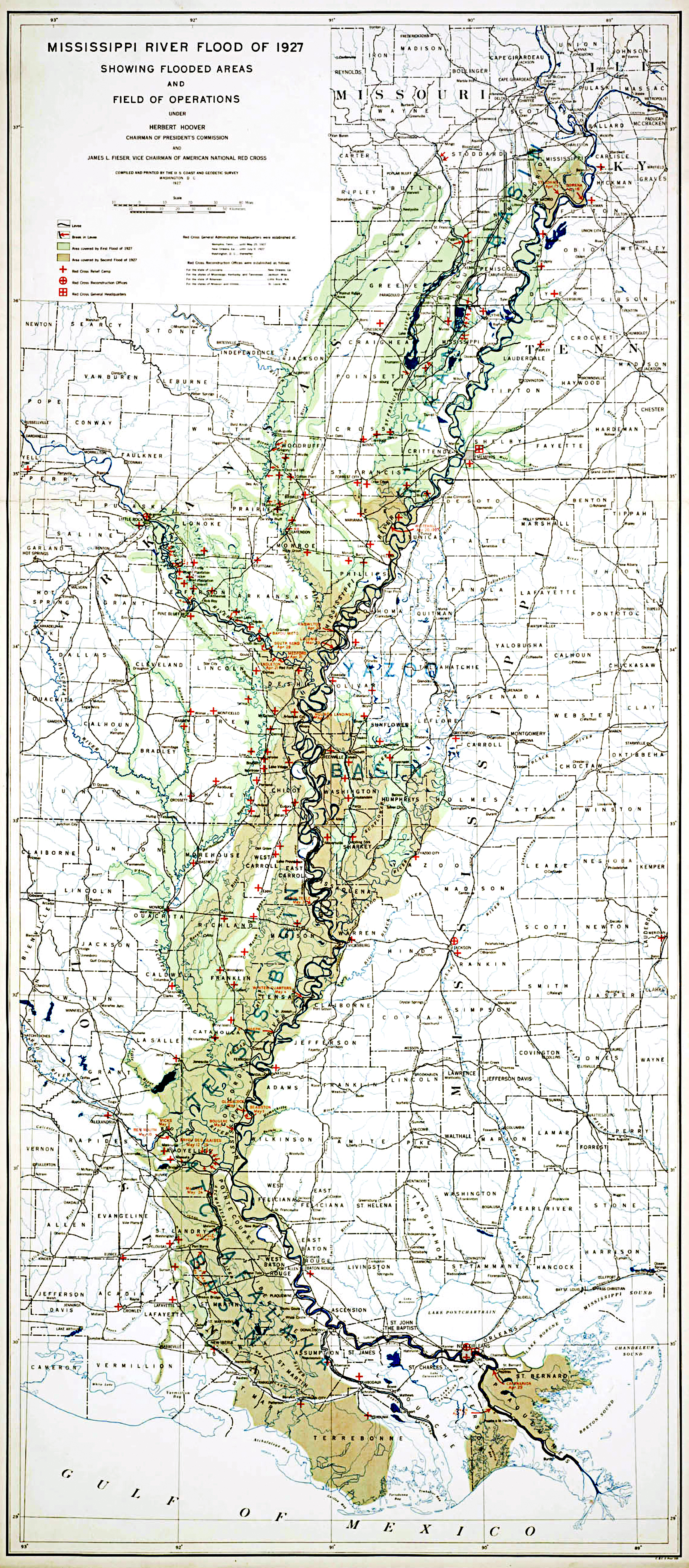
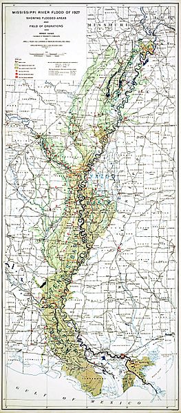
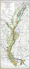
Image: 1927 LA Flood Map
Size of this preview: 263 × 598 pixels. Other resolutions: 105 × 240 pixels | 2,292 × 5,214 pixels.
Original image (2,292 × 5,214 pixels, file size: 9.56 MB, MIME type: image/jpeg)
Description: MIssissippi River Flood of 1927 Showing Flooded Areas and Field of Operations
Title: 1927 LA Flood Map
Credit: Records of the Coast and Geodetic Survey, RG 23 https://www.archives.gov/global-pages/larger-image.html?i=/publications/prologue/2007/spring/images/coast-miss-flood-l.jpg&c=/publications/prologue/2007/spring/images/coast-miss-flood.caption.html https://www.archives.gov/
Author: Coast and Geodetic Survey
Usage Terms: Public domain
License: Public domain
Attribution Required?: No
Image usage
The following page links to this image:

All content from Kiddle encyclopedia articles (including the article images and facts) can be freely used under Attribution-ShareAlike license, unless stated otherwise.