
Image: 1933 HMS Norfolk Summer cruise map
Size of this preview: 377 × 599 pixels. Other resolutions: 151 × 240 pixels | 4,171 × 6,627 pixels.
Original image (4,171 × 6,627 pixels, file size: 3.62 MB, MIME type: image/jpeg)
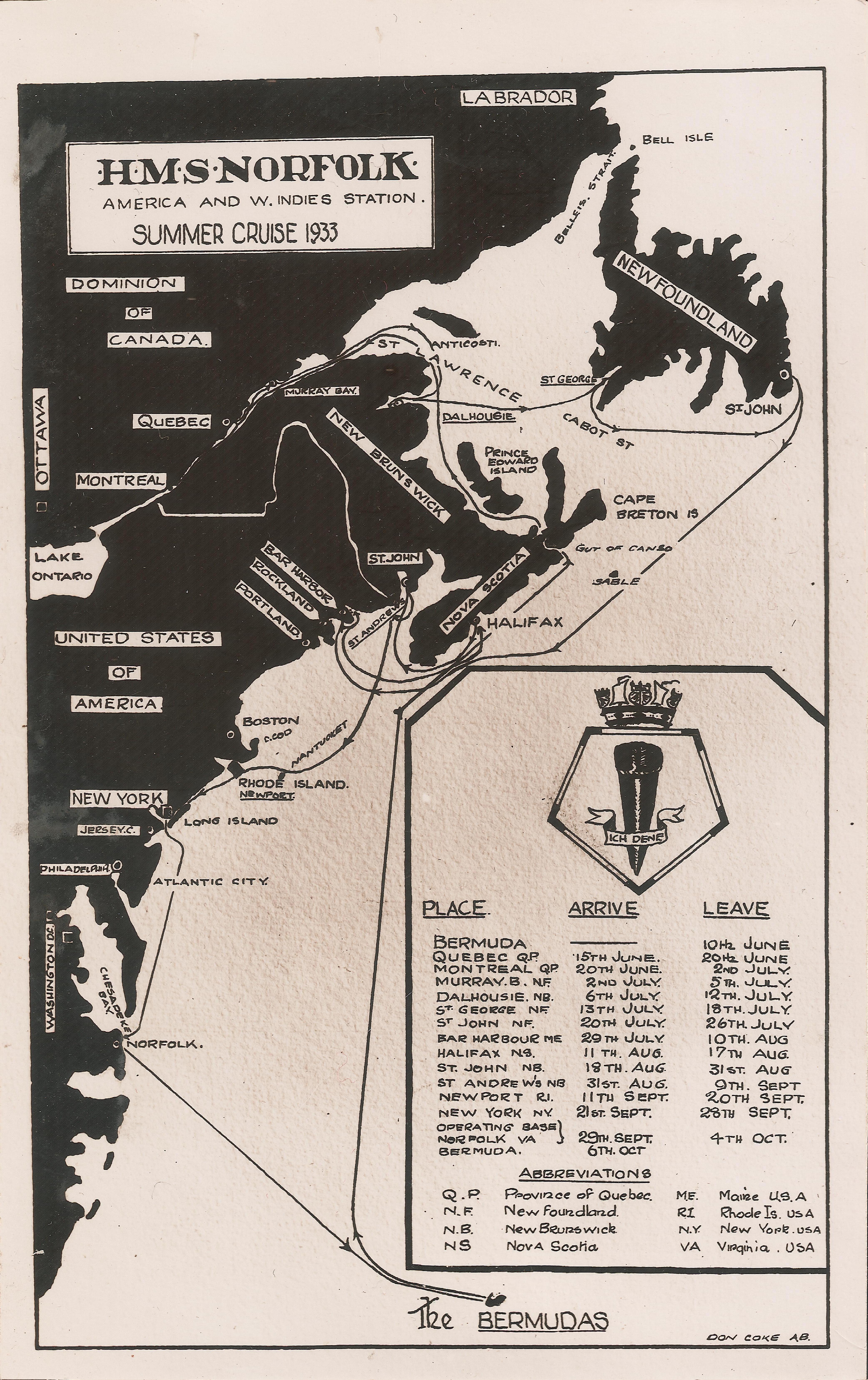
Description: A map of the 1933 summer cruise of HMS Norfolk, beginning and ending at its base at the Royal Naval Dockyard on Ireland Island in Bermuda. Visits were made to various ports in Dominion of Canada, the Dominion of Newfoundland, and the United States of America.
Title: 1933 HMS Norfolk Summer cruise map
Credit: Self-scanned
Author: AB Don Coke, Royal Navy
Usage Terms: Public domain
License: Public domain
Attribution Required?: No
Image usage
The following page links to this image:

All content from Kiddle encyclopedia articles (including the article images and facts) can be freely used under Attribution-ShareAlike license, unless stated otherwise.