
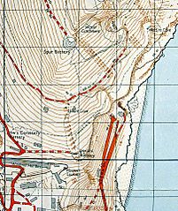
Image: 1961 Military Map of Gibraltar (south east)

Size of this preview: 503 × 599 pixels. Other resolutions: 201 × 240 pixels | 806 × 960 pixels.
Original image (806 × 960 pixels, file size: 212 KB, MIME type: image/jpeg)
Description: South east section of a map of Gibraltar published by the UK War Office and Air Ministry in 1961.
Title: 1961 Military Map of Gibraltar (south east)
Credit: Map of Gibraltar
Author: UK War Office and Air Ministry
Usage Terms: Public domain
License: Public domain
Attribution Required?: No
Image usage
The following page links to this image:

All content from Kiddle encyclopedia articles (including the article images and facts) can be freely used under Attribution-ShareAlike license, unless stated otherwise.
.jpg)