
Image: 2017 Scottish local elections - Ward and Council Control

Size of this PNG preview of this SVG file: 800 × 392 pixels. Other resolution: 320 × 157 pixels.
Original image (SVG file, nominally 1,141 × 559 pixels, file size: 8.64 MB)
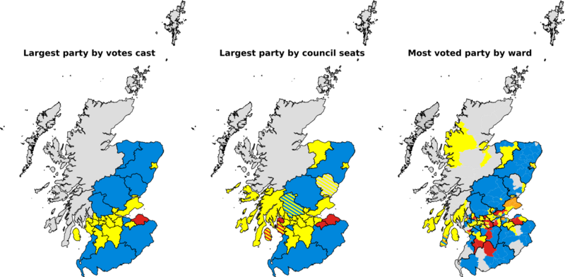
Description: Map of the results of the 2017 Scottish local elections. The map portrays (from left to right) outright party control by council, the largest party by council, and the largest/most popular party (in terms of votes) by ward.
Title: 2017 Scottish local elections - Ward and Council Control
Credit: Own work. Made utilising resources from the Boundary Commission for Scotland.
Author: MrPenguin20, coloured by Brythones
Usage Terms: Creative Commons Attribution-Share Alike 4.0
License: CC BY-SA 4.0
License Link: https://creativecommons.org/licenses/by-sa/4.0
Attribution Required?: Yes
Image usage
The following page links to this image:

All content from Kiddle encyclopedia articles (including the article images and facts) can be freely used under Attribution-ShareAlike license, unless stated otherwise.