
Image: 2022 11 13 - Map West Germanic – cc. 476 CE - final
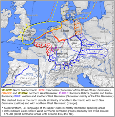
Size of this preview: 587 × 600 pixels. Other resolutions: 235 × 240 pixels | 2,752 × 2,811 pixels.
Original image (2,752 × 2,811 pixels, file size: 2.36 MB, MIME type: image/png)
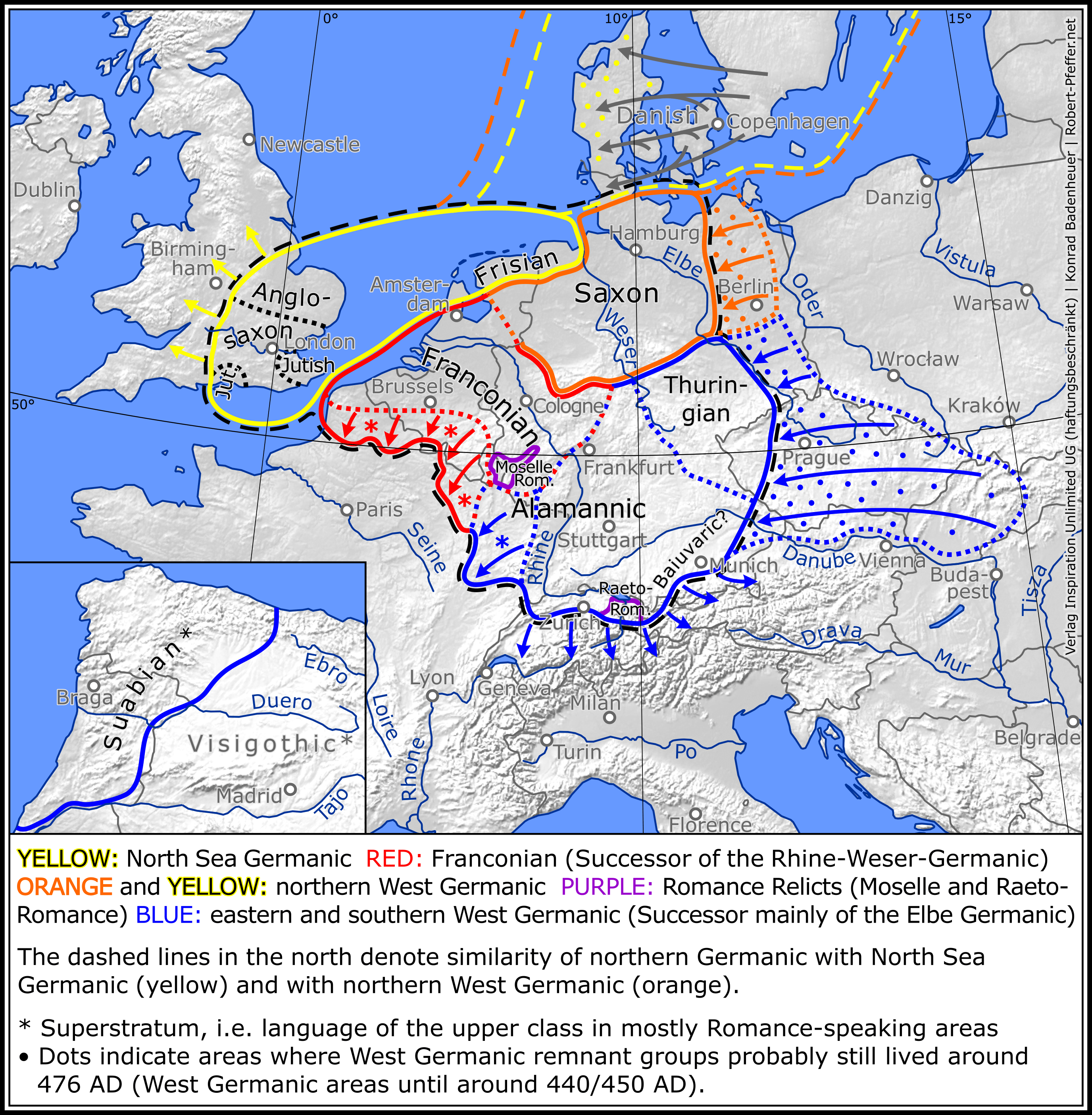
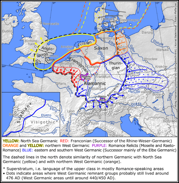
Description: Das westgermanische Sprachgebiet um 476 n. Chr. (zur Zeit des Untergangs des Römischen Reiches)
Title: 2022 11 13 - Map West Germanic – cc. 476 CE - final
Credit: Own work
Author: DownUnder36
Usage Terms: Creative Commons Attribution-Share Alike 4.0
License: CC BY-SA 4.0
License Link: https://creativecommons.org/licenses/by-sa/4.0
Attribution Required?: Yes
Image usage
The following page links to this image:

All content from Kiddle encyclopedia articles (including the article images and facts) can be freely used under Attribution-ShareAlike license, unless stated otherwise.