
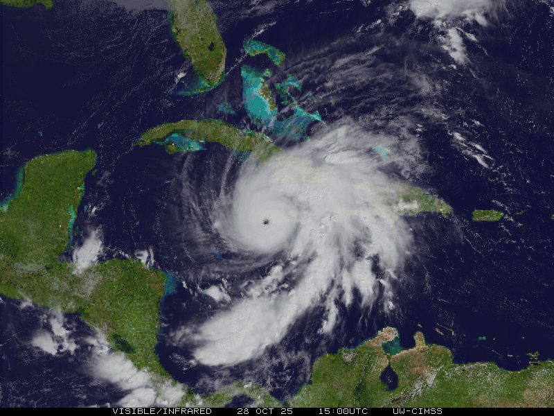
Image: 2025 CIMSS 13L Melissa visible infrared satellite loop
No higher resolution available.
2025_CIMSS_13L_Melissa_visible_infrared_satellite_loop.gif (800 × 600 pixels, file size: 4.05 MB, MIME type: image/gif, looped, 12 frames, 2.7 s)
Description: Cooperative Institute for Meteorological Satellite Studies's visible infrared satellite loop of atlantic hurricane Melissa.
Usage Terms: Public domain
Image usage
The following page links to this image:

All content from Kiddle encyclopedia articles (including the article images and facts) can be freely used under Attribution-ShareAlike license, unless stated otherwise.