
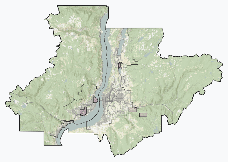
Image: 26 Central Okanagan Regional District British Columbia

Size of this PNG preview of this SVG file: 800 × 569 pixels. Other resolution: 320 × 228 pixels.
Original image (SVG file, nominally 1,022 × 727 pixels, file size: 13.46 MB)
Description: Experimental SVG overview of British Columbia's regional districts, using open CEC Landsat-derived land cover data (2010) to generate a naturalistic colour scheme. More information here. Vector features are from Statistics Canada and BC Open Data. Indian reserves are depicted with a red shapeburst fill. Projection is Web Mercator (EPSG:3857). This graphic was created with QGIS
Title: 26 Central Okanagan Regional District British Columbia
Credit: Own work
Author: awmcphee
Usage Terms: Creative Commons Zero, Public Domain Dedication
License: CC0
License Link: http://creativecommons.org/publicdomain/zero/1.0/deed.en
Attribution Required?: No
Image usage
The following page links to this image:

All content from Kiddle encyclopedia articles (including the article images and facts) can be freely used under Attribution-ShareAlike license, unless stated otherwise.