
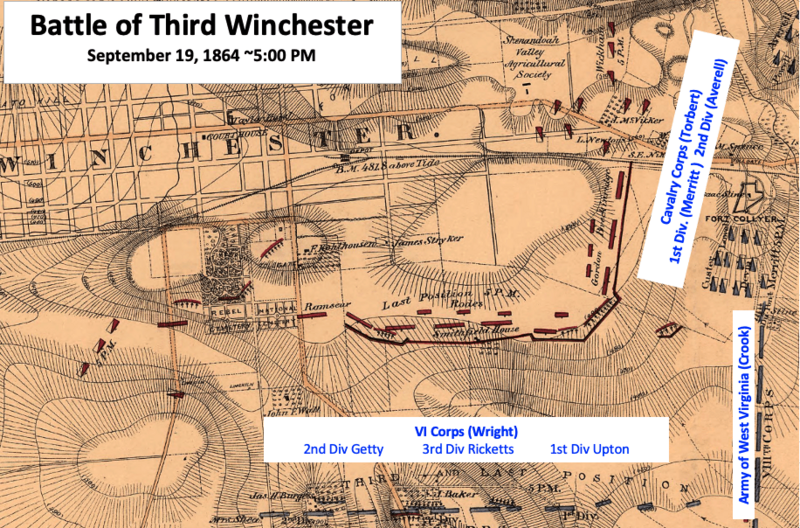
Image: 3rd Winchester Final Stand View from east

Size of this preview: 800 × 528 pixels. Other resolutions: 320 × 211 pixels | 916 × 604 pixels.
Original image (916 × 604 pixels, file size: 440 KB, MIME type: image/png)
Description: Map shows troop positions near 5:00 PM in Third Battle of Winchester in the American Civil War.
Title: 3rd Winchester Final Stand View from east
Credit: This is a portion of an 1873 map titled "Battle field of Winchester, Va. (Opequon) [September 19, 1864]" prepared by an order of Lt. Gen. P.H. Sheridan under the authority of the Secretary of War. The entire map can be found in the Library of Congress map, and shows the battlefield.
Author: Bvt. Lt. Col. G. L. Gillespie, Major of Engineers, U.S.A. under the authority of the U.S. Secretary of War
Usage Terms: Public domain
License: Public domain
Attribution Required?: No
Image usage
The following page links to this image:

All content from Kiddle encyclopedia articles (including the article images and facts) can be freely used under Attribution-ShareAlike license, unless stated otherwise.