
Image: 3rd Winchester Map Noon
Size of this preview: 642 × 600 pixels. Other resolutions: 257 × 240 pixels | 701 × 655 pixels.
Original image (701 × 655 pixels, file size: 278 KB, MIME type: image/png)
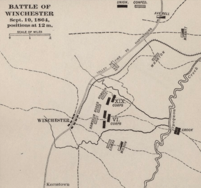
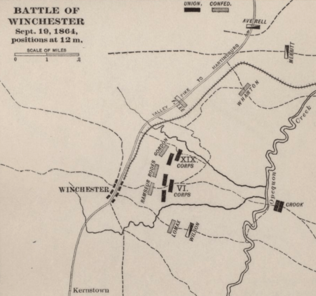
Description: Map shows the Union and Confederate troop positions in the Third Battle of Winchester (a.k.a. Battle of Opequon) at noon on September 19, 1864. Union General Philip Sheridan defeated the outnumbered Confederate General Jubal Early in this American Civil War battle.
Title: 3rd Winchester Map Noon
Credit: This is a portion of the 44th image a 1914 Atlas titled "Campaigns of the American Civil War--atlas" The entire page can be found in the Library of Congress page, and the atlas can be found here.
Author: G. J. Fiebeger
Usage Terms: Public domain
License: Public domain
Attribution Required?: No
Image usage
The following page links to this image:

All content from Kiddle encyclopedia articles (including the article images and facts) can be freely used under Attribution-ShareAlike license, unless stated otherwise.