
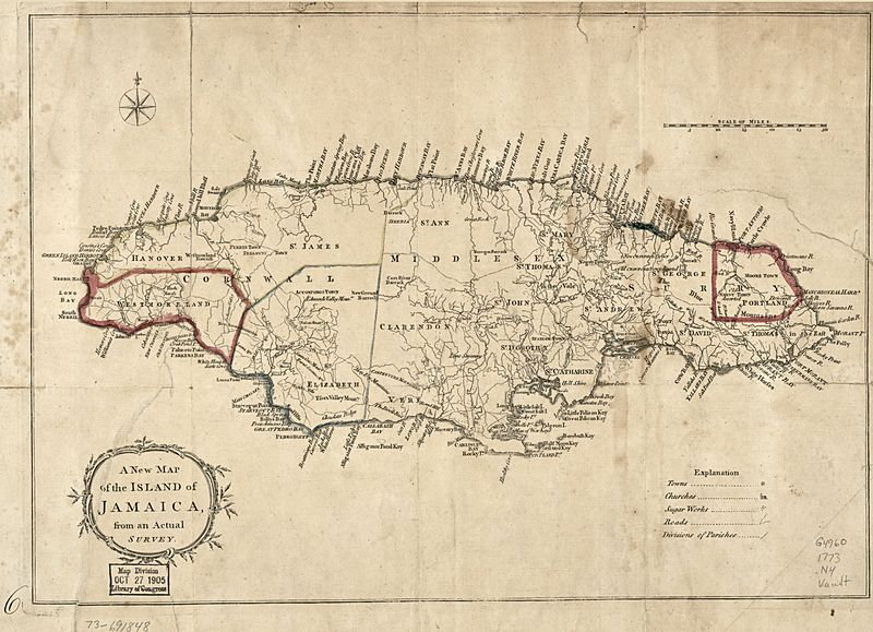
Image: A New map of the island of Jamaica, from an actual survey. LOC 73691848

Size of this preview: 800 × 579 pixels. Other resolutions: 320 × 232 pixels | 5,964 × 4,320 pixels.
Original image (5,964 × 4,320 pixels, file size: 2.95 MB, MIME type: image/jpeg)
Description: Scale ca. 1:700,000. LC Maps of North America, 1750-1789, 1928 Available also through the Library of Congress Web site as a raster image. No. "6" in lower left margin. Vault. AACR2
Title: A New map of the island of Jamaica, from an actual survey. LOC 73691848
Credit: https://www.loc.gov/item/73691848/
Author: Unknown authorUnknown author
Permission: This map is available from the United States Library of Congress's Geography & Map Division under the digital ID g4960.ar192800. This tag does not indicate the copyright status of the attached work. A normal copyright tag is still required. See Commons:Licensing.
Usage Terms: Public domain
License: Public domain
Attribution Required?: No
Image usage
The following page links to this image:

All content from Kiddle encyclopedia articles (including the article images and facts) can be freely used under Attribution-ShareAlike license, unless stated otherwise.