
Image: A Plan of English Harbour WDL655
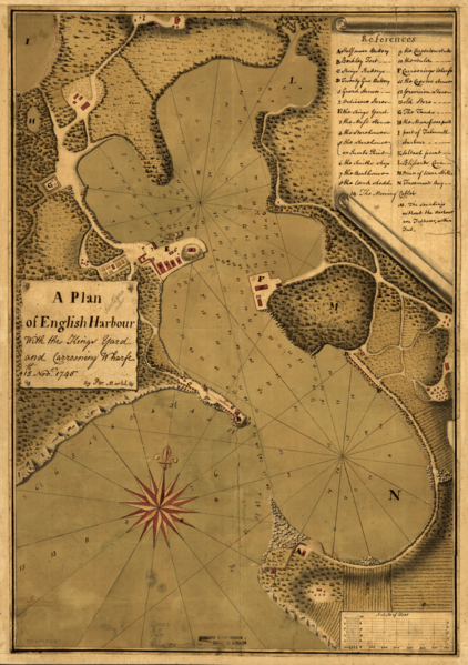
Description: This well-executed, colored British map is of English Harbour, Antigua, one of the principal port facilities for British activities in the Caribbean in the18th century. The map shows the coastline, coastal features, extensive soundings, a navigational hazard, fortifications, shipyards, cultivated fields and vegetation, and an ornate wind rose. It also includes a keyed legend. The map indicates that the primary purpose of the port was as a naval depot and dry dock. The map is from the Howe Collection at the Library of Congress, which was acquired in 1905 from descendants of Admiral Lord Richard Howe (1726-99), who served as commander in chief of the British fleet in North America during the first two years of the American Revolutionary War. English Harbour (Antigua and Barbuda); Harbors
Title: A Plan of English Harbour
Credit: http://dl.wdl.org/655.png Gallery: http://www.wdl.org/en/item/655/
Author: Martel, Peter
Usage Terms: Public domain
License: Public domain
Attribution Required?: No
Image usage
The following page links to this image:
