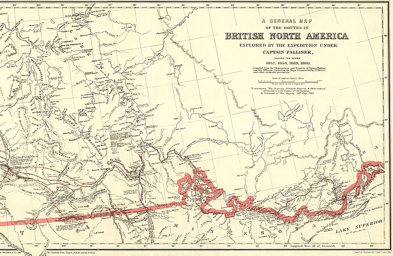
Image: A Section of a General Map of the Routes in British North America Explored by the Expedition Under Captain Palliser (1865) (2211818555)

Description: A Section of a General Map of the Routes in British North America Explored by the Expedition Under Captain Palliser (1865) The final map in Palliser’s Report is one of the most visually attractive and most significant maps ever published of the area From Lake Superior to the Pacific Ocean. Material from it was often incorporated in other maps in future years. A very clearly conceived map, it is carefully organized, coping gracefully and seemingly effortlessly with a tremendous amount of information. Perhaps a considerable part of the credit for this map should go to Stanford’s Geographical Establishment, which produce it. The map shows the gross natural patterns of the interior extraordinarily effectively. The three prairie steppes, and the great vegetation, climatic, and land capability divisions, including the Fertile Belt for which Palliser is so famous, are all clearly delineated. Many of the major relief features are exaggerated. Geologic features are usually mentioned in descriptive annotations printed on the body of the map, and there are also interpretive remarks such as the reference to the Ancient Lake bottom in the Red River Plain. Some cultural features are shown, the population of Fort Garry is given, and there are very many Place names. There are errors of location, amounting to over 10 miles in some instances, but by and large the main features are accurately enough related to one another so that one is not bothered by these mistakes. The map does tie together a tremendous amount of material on the West in an appealing format. It is truly a masterful example of the cartographer’s craft. (Warkentin and Ruggles. Historical Atlas of Manitoba. map 93, p. 224) A General Map of the Routes in British North America Explored by the Expedition under Captain Palliser, During the Years 1857, 1858, 1859, 1860. Compiled from the Observations and Reports of Captain Palliser and his Officers, including the Maps constructed by Dr. Hector, and other authentic documents. 1865. Scale 1 inch to 14.5 miles. Routes are in red. Produced by Stanford’s Geographical Estab. London. The map was issued with the index to Captain Palliser’s Reports. Printed in Great Britain, Parliamentary Papers. Index and Maps to Captain Palliser’s Reports, Showing The Date of Each Journey, the Route, and the Page in which it is described in the Copies of the Reports laid before Parliament on the 19th May 1863. Presented to both Houses of Parliament by Command of Her Majesty. 1865. London: Printed by G.E. Eyre and W. Spottiswoode, 1865.
Title: A Section of a General Map of the Routes in British North America Explored by the Expedition Under Captain Palliser (1865) (2211818555)
Credit: A Section of a General Map of the Routes in British North America Explored by the Expedition Under Captain Palliser (1865)
Author: Wyman Laliberte from Edmonton, Canada
Usage Terms: Public domain
License: Public domain
Attribution Required?: No
Image usage
The following 2 pages link to this image:

