
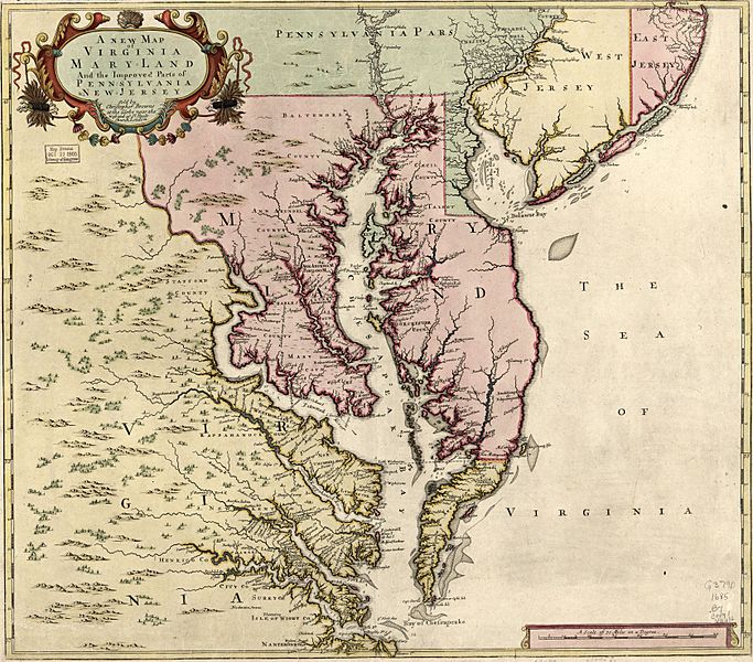
Image: A new map of Virginia, Maryland, and the improved parts of Pennsylvania & New Jersey. LOC 2005630923 (cropped)

Description: Relief shown pictorially. Depths shown by soundings. Date and attribution from On the Map, 1983 (Figure 24). First state of map published originally in 1685 by Christopher Browne with the imprint in the cartouche under the title. No longitude lines are given. Available also through the Library of Congress Web site as a raster image. LC copy annotated with pencil in bottom margin. Stamped and annotated in blue ink on verso: 24. LC copy imperfect: Loose binding along bottom margin.
Title: A new map of Virginia, Maryland, and the improved parts of Pennsylvania & New Jersey. LOC 2005630923 (cropped)
Credit: https://www.loc.gov/item/2005630923/
Author: Browne, Christopher
Permission: This map is available from the United States Library of Congress's Geography & Map Division under the digital ID g3790.ct004098. This tag does not indicate the copyright status of the attached work. A normal copyright tag is still required. See Commons:Licensing for more information.
Usage Terms: Public domain
License: Public domain
Attribution Required?: No
Image usage
The following 3 pages link to this image:

.jpg)