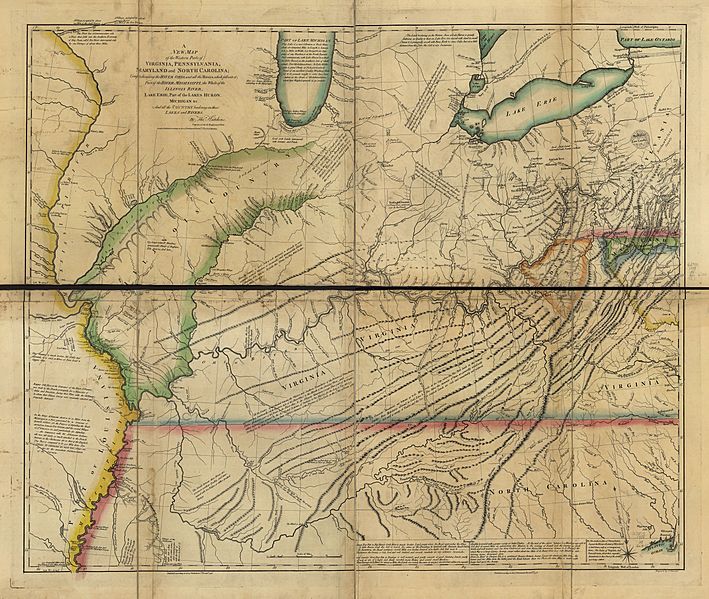
Image: A new map of the western parts of Virginia, Pennsylvania, Maryland, and North Carolina; comprehending the River Ohio, and all the rivers, which fall into it; part of the River Mississippi, the whole LOC gm71002165

Description: Scale ca. 1:1,270,000. Hand colored. Prime meridian: Philadelphia and London. Relief shown pictorially and by hachures. Includes descriptive and historical notes. Supplements the author's A topographical description of Virginia, Pennsylvania, Maryland, and North Carolina. Brown, Lloyd Arnold. Early maps of the Ohio Valley. 51 LC Maps of North America, 1750-1789, 789 Available also through the Library of Congress Web site as a raster image. Vault AACR2: 100; 440; 651/1; 651/2; 700/1
Title: A new map of the western parts of Virginia, Pennsylvania, Maryland, and North Carolina; comprehending the River Ohio, and all the rivers, which fall into it; part of the River Mississippi, the whole LOC gm71002165
Credit: https://www.loc.gov/item/gm71002165/
Author: Hutchins, Thomas; Cheevers, T.
Permission: This map is available from the United States Library of Congress's Geography & Map Division under the digital ID g3707o.ar078901. This tag does not indicate the copyright status of the attached work. A normal copyright tag is still required. See Commons:Licensing for more information.
Usage Terms: Public domain
License: Public domain
Attribution Required?: No
Image usage
The following 2 pages link to this image:

