
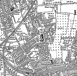
Image: Acton Green OS map 1894
No higher resolution available.
Acton_Green_OS_map_1894.png (260 × 256 pixels, file size: 52 KB, MIME type: image/png)
Description: Ordnance Survey map of Acton Green, west London, 1894
Title: Acton Green OS map 1894
Credit: https://www.francisfrith.com/acton-green,hounslow/chiswick-1893-1894_hosm65635
Author: Ordnance Survey
Permission: Public domain. OS maps before 2015 become public domain 50 years after first publication, and include any subsequent reprint of the original, official or otherwise. This includes any republication from the original with adaptions, additions, redrawing, manipulation or incorporation into other images. See https://www.ordnancesurvey.co.uk/governance/crown-copyright
Usage Terms: Public domain
License: Public domain
Attribution Required?: No
Image usage
The following page links to this image:

All content from Kiddle encyclopedia articles (including the article images and facts) can be freely used under Attribution-ShareAlike license, unless stated otherwise.