
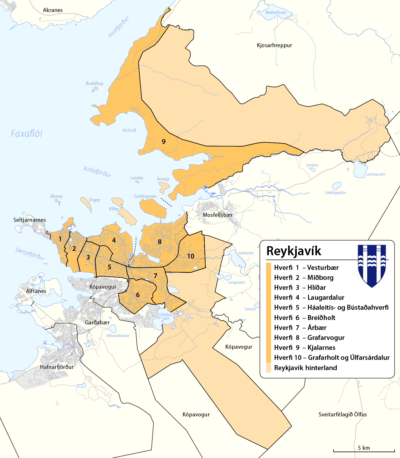
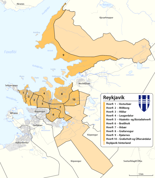
Image: Administrative map of Reykjavík
Description: Map of adminstartive units of Reykjavík
Title: Administrative map of Reykjavík
Credit: Own work, using OpenStreetMap data for the background the coat of arms of Reykjavík Hverfaskipting Reykjavíkur diverse maps on the Kortasjár site] of Landmælingar Íslands, especially this one the term Reykjavík Hinterland ist taken from page 15 of this brochure
Author: Maximilian Dörrbecker (Chumwa)
Permission: This file is licensed under the Creative Commons Attribution-Share Alike 2.0 Generic license. You are free: to share – to copy, distribute and transmit the work to remix – to adapt the work Under the following conditions: attribution – You must attribute the work in the manner specified by the author or licensor (but not in any way that suggests that they endorse you or your use of the work). share alike – If you alter, transform, or build upon this work, you may distribute the resulting work only under the same or similar license to this one. http://creativecommons.org/licenses/by-sa/2.0 CC BY-SA 2.0 Creative Commons Attribution-Share Alike 2.0 truetrue Contains map data © OpenStreetMap contributors, made available under the terms of the Open Database License (ODbL). The ODbL does not require any particular license for maps produced from ODbL data; map tiles produced by the OpenStreetMap foundation are licensed under the CC-BY-SA-2.0 licence, but maps produced by other people may be subject to other licences.Open Database LicenseODbLhttp://opendatacommons.org/licenses/odbl/1.0/true
Usage Terms: Creative Commons Attribution-Share Alike 2.0
License: CC BY-SA 2.0
License Link: http://creativecommons.org/licenses/by-sa/2.0
Attribution Required?: Yes
Image usage
The following page links to this image:
