
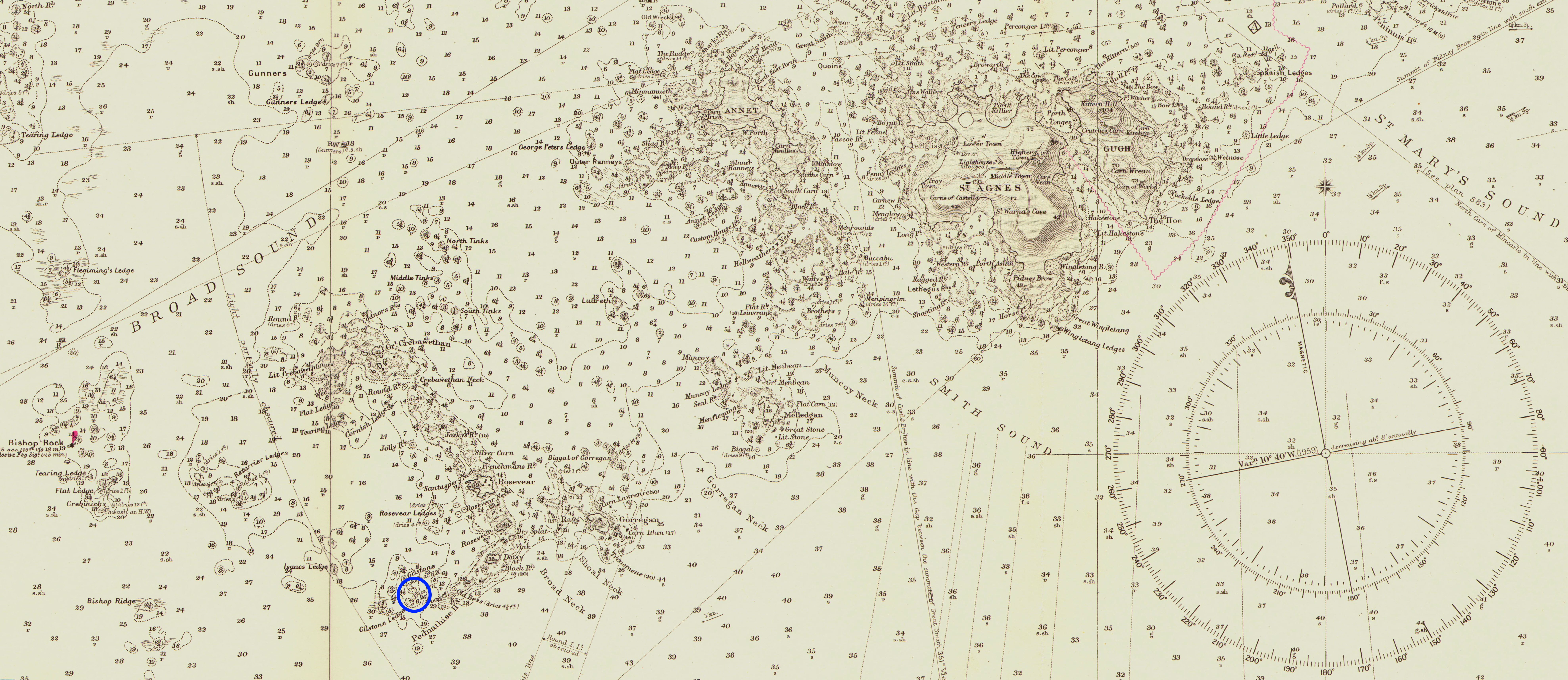
Image: Admiralty Chart No 34 The Scilly Isles - section showing the HMS Association wreck location
Description: Section of Admiralty Chart of the Isles of Scilly showing the location of the wreck site of H.M.S. Association, lost in 1707 on the Gilstone Rocks. Derived from file:Admiralty Chart 34 The Scilly Isles published 1911.jpg. The location of the wreck is from: Isles of Scilly: Designated Wrecks Interpretation. CISMAS. Cornwall and Isles of Scilly Maritime Archaeology Society. Retrieved on 20 January 2020.
Title: Admiralty Chart No 34 The Scilly Isles - section showing the HMS Association wreck location
Credit: Own work
Author: Kognos
Usage Terms: Creative Commons Attribution-Share Alike 4.0
License: CC BY-SA 4.0
License Link: https://creativecommons.org/licenses/by-sa/4.0
Attribution Required?: Yes
Image usage
The following page links to this image:
