
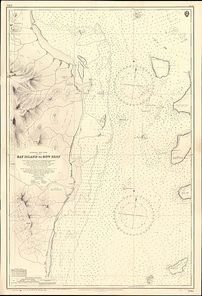
Image: Admiralty Chart No 3762 Hay Island to Bow Reef, Published 1911

Size of this preview: 409 × 599 pixels. Other resolutions: 164 × 240 pixels | 11,090 × 16,254 pixels.
Original image (11,090 × 16,254 pixels, file size: 45.47 MB, MIME type: image/jpeg)
Description: Nautical chart of Hay Island to Bow Reef. North of Morris Island surveyed by Lieut. Commander W.V.S. Howard and the officers of H.M. Surveying Ship Dart, 1896-1897; South of Morris Island surveyed by Lieut. Commander J.F. Parry, H.M. Surveying Ship Dart, 1898. Not current - not to be used for navigation!
Title: Admiralty Chart No 3762 Hay Island to Bow Reef, Published 1911
Credit: Scan of original Admiralty Chart
Author: United Kingdom Hydrographic Office
Usage Terms: Public domain
License: Public domain
Attribution Required?: No
Image usage
The following page links to this image:

All content from Kiddle encyclopedia articles (including the article images and facts) can be freely used under Attribution-ShareAlike license, unless stated otherwise.