
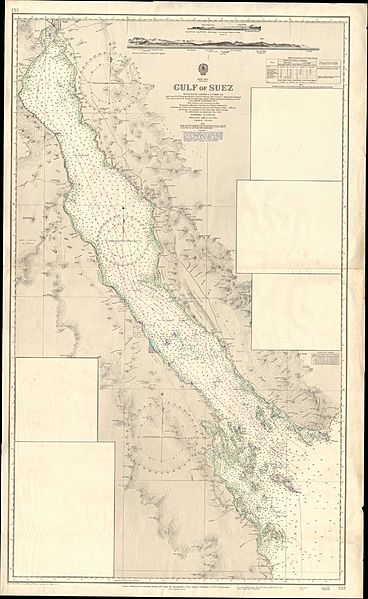
Image: Admiralty Chart No 757 Gulf of Suez, Published 1873

Size of this preview: 368 × 599 pixels. Other resolutions: 147 × 240 pixels | 11,330 × 18,435 pixels.
Original image (11,330 × 18,435 pixels, file size: 38.72 MB, MIME type: image/jpeg)
Description: Nautical chart of the Gulf of Suez. Surveyed by Captain G.S. Nares, Navg. Lieuts T.H. Tizard & J. Millard, Lieut. C. Fellowes, Sub-Lieuts. W.U. Moore & G.R. Bethell, Navg. Sub-Lieuts. P.H. Wright & A. Havergall, Messrs. Oldham & Richardson, H.M.S. Newport & Shearwater, 1871-2. Not current - not to be used for navigation!
Title: Admiralty Chart No 757 Gulf of Suez, Published 1873
Credit: Scan of original Admiralty Chart
Author: United Kingdom Hydrographic Office
Usage Terms: Public domain
License: Public domain
Attribution Required?: No
Image usage
The following page links to this image:

All content from Kiddle encyclopedia articles (including the article images and facts) can be freely used under Attribution-ShareAlike license, unless stated otherwise.