
Image: Aerial View of Scraesdon Fort and Antony - geograph.org.uk - 340331
No higher resolution available.
Aerial_View_of_Scraesdon_Fort_and_Antony_-_geograph.org.uk_-_340331.jpg (640 × 422 pixels, file size: 86 KB, MIME type: image/jpeg)
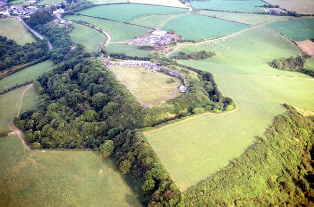
Description: Aerial View of Scraesdon Fort and Antony This picture clearly shows the outline of Scraesdon Fort with its defensive moat filled with mature trees. The village of Antony is in the picture as is Scraesdon Farm and all roads contained within the 1km square map image.
Title: Aerial View of Scraesdon Fort and Antony - geograph.org.uk - 340331
Credit: From geograph.org.uk
Author: Bill Booth
Usage Terms: Creative Commons Attribution-Share Alike 2.0
License: CC BY-SA 2.0
License Link: https://creativecommons.org/licenses/by-sa/2.0
Attribution Required?: Yes
Image usage
The following page links to this image:

All content from Kiddle encyclopedia articles (including the article images and facts) can be freely used under Attribution-ShareAlike license, unless stated otherwise.