
Image: Aerial view (drawing) of Eisenhower National Historic Site, Pennsylvania
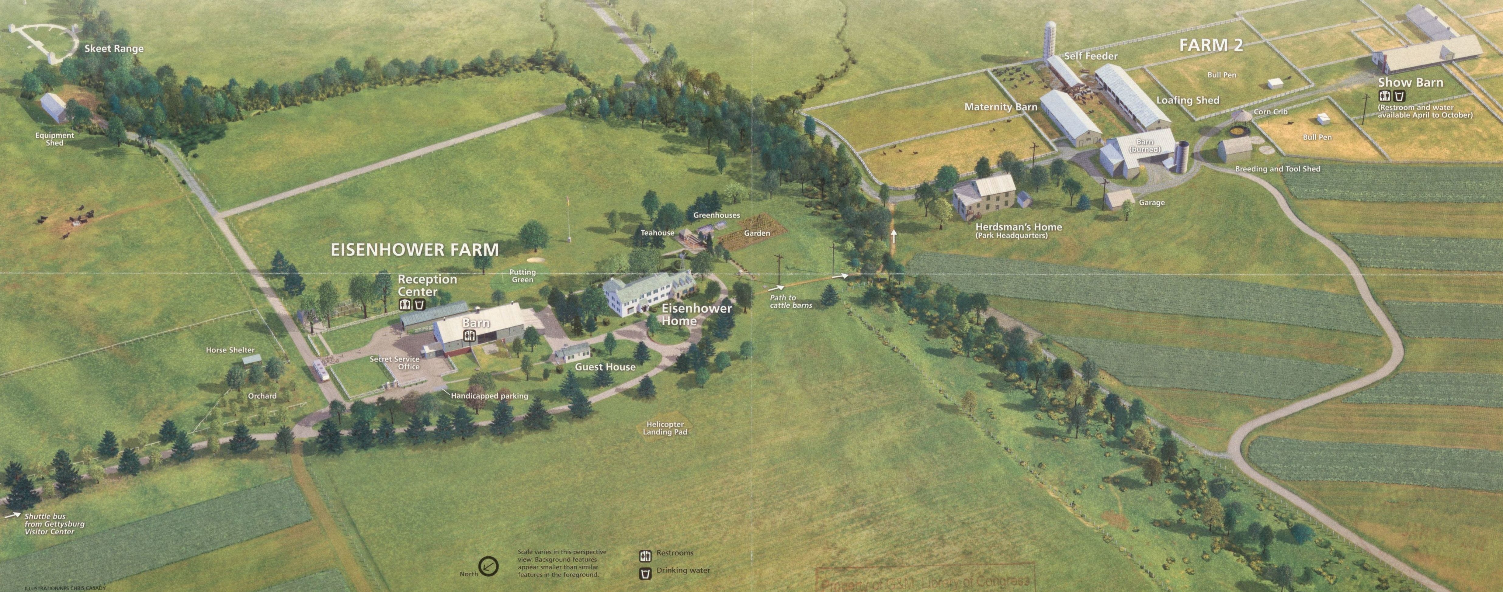
Description: Aerial view (drawing) of the Eisenhower farmstead near Gettysburg (Pa.); drawn/designed by Chris Casady; printed in the Eisenhower National Historic Site brochures from 2005 until 2010. "*GPO:2012--372-849/80819 Reprint 2010." Title from panel. Oriented with north toward the lower left. Includes text and ill. Text, chronology, and ill. (some col.) on verso. Available also through the Library of Congress Web site as a raster image.
Title: Aerial view (drawing) of Eisenhower National Historic Site, Pennsylvania
Credit: https://www.loc.gov/item/2012585125/
Author: United States. National Park Service; Casady, Chris
Permission: This map is available from the United States Library of Congress's Geography & Map Division under the digital ID g3822e.ct007941. This tag does not indicate the copyright status of the attached work. A normal copyright tag is still required. See Commons:Licensing.
Usage Terms: Public domain
License: Public domain
Attribution Required?: No
Image usage
The following image is a duplicate of this image (more details):
_(cropped).jpg)
The following page links to this image:

_of_Eisenhower_National_Historic_Site,_Pennsylvania.jpg)