
Image: Aerial view of Bear Lake, Idaho-Utah

Size of this preview: 800 × 345 pixels. Other resolutions: 320 × 138 pixels | 6,918 × 2,981 pixels.
Original image (6,918 × 2,981 pixels, file size: 3.41 MB, MIME type: image/jpeg)
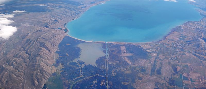
Description: A view from an airplane of Bear Lake, located at the border of Idaho and Utah. Mud Lake and North Beach State Park is visible in the center-left. The outlet canal is visible in the center. The towns of St Charles, Idaho and Fish Haven, Idaho are visible to the right.
Title: Aerial view of Bear Lake, Idaho-Utah
Credit: Own work
Author: Vladsinger
Usage Terms: Creative Commons Attribution-Share Alike 4.0
License: CC BY-SA 4.0
License Link: https://creativecommons.org/licenses/by-sa/4.0
Attribution Required?: Yes
Image usage
The following page links to this image:

All content from Kiddle encyclopedia articles (including the article images and facts) can be freely used under Attribution-ShareAlike license, unless stated otherwise.