
Image: Aerial view of East Tamaki, 1949
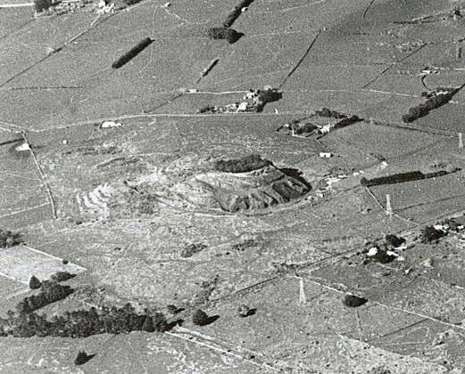
Description: Aerial view of part of East Tamaki, 28 June 1949. The photograph was taken looking across the Pakuranga Creek. Springs Road and Harris Road cross the scene diagonally left to right. The volcanic cone of Green Mount, which was being quarried at the time, can be seen towards the middle left. This was one of the sites considered for the future Auckland International Airport. Auckland Libraries Heritage Collections Footprints 06056
Title: Aerial view of East Tamaki, 1949
Credit: https://kura.aucklandlibraries.govt.nz/digital/collection/photos/id/39185
Author: Whites Aviation
Usage Terms: Creative Commons Attribution 4.0
License: CC BY 4.0
License Link: https://creativecommons.org/licenses/by/4.0
Attribution Required?: Yes
Image usage
The following page links to this image:
