
Image: Aerial view of Green Hill, East Tāmaki, 1964
Size of this preview: 773 × 599 pixels. Other resolutions: 310 × 240 pixels | 2,000 × 1,551 pixels.
Original image (2,000 × 1,551 pixels, file size: 404 KB, MIME type: image/jpeg)
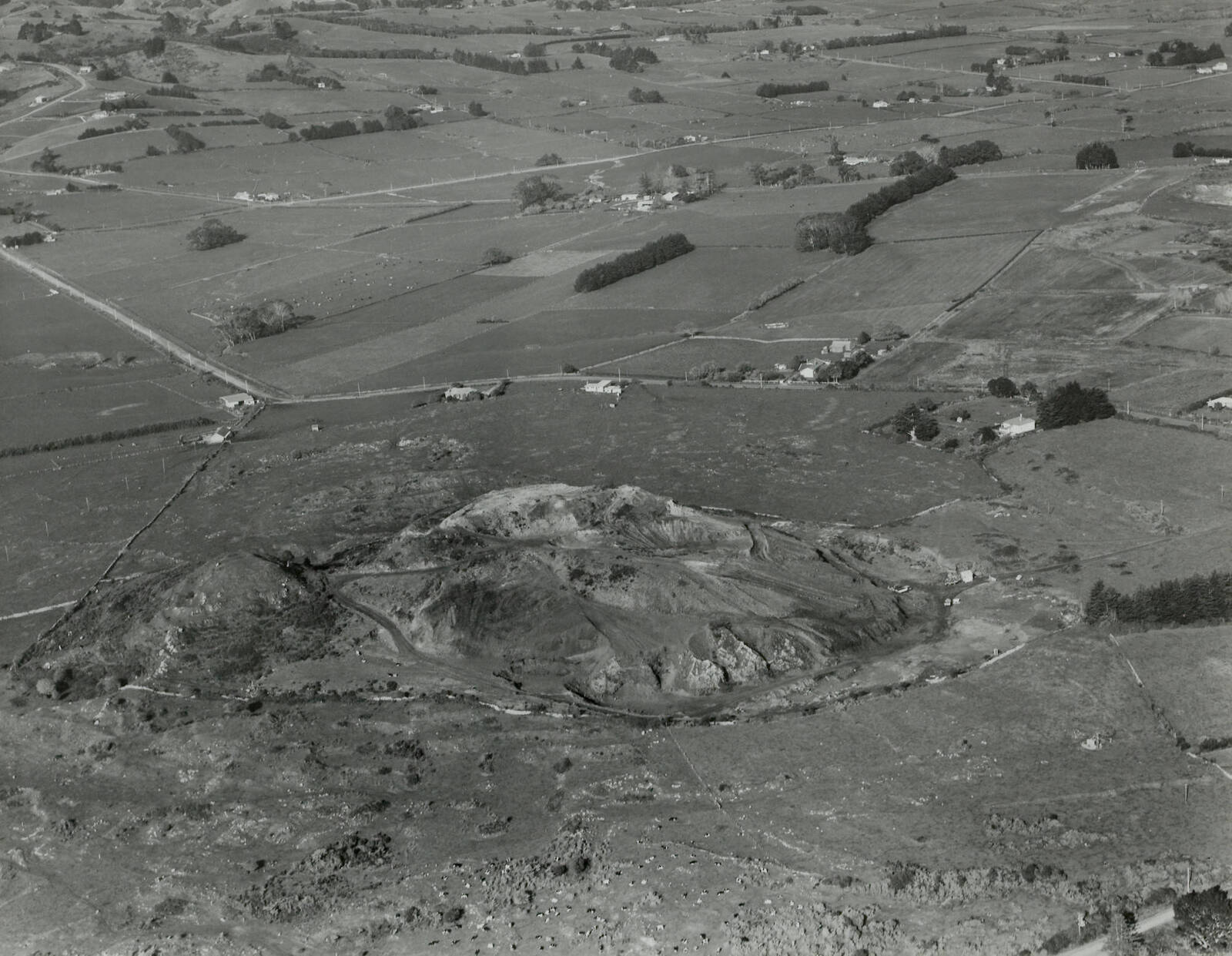
Description: Aerial view of part of East Tāmaki, 21 May 1964. This shows the volcanic cone known as Green Mount (since destroyed). Smales Road can be seen immediately beyond. Chapel Road runs across the photo in the background. Auckland Libraries Heritage Collections Footprints 06011
Title: Aerial view of Green Hill, East Tāmaki, 1964
Credit: https://kura.aucklandlibraries.govt.nz/digital/collection/photos/id/36108
Author: Whites Aviation
Usage Terms: Creative Commons Attribution 4.0
License: CC BY 4.0
License Link: https://creativecommons.org/licenses/by/4.0
Attribution Required?: Yes
Image usage
The following page links to this image:

All content from Kiddle encyclopedia articles (including the article images and facts) can be freely used under Attribution-ShareAlike license, unless stated otherwise.