
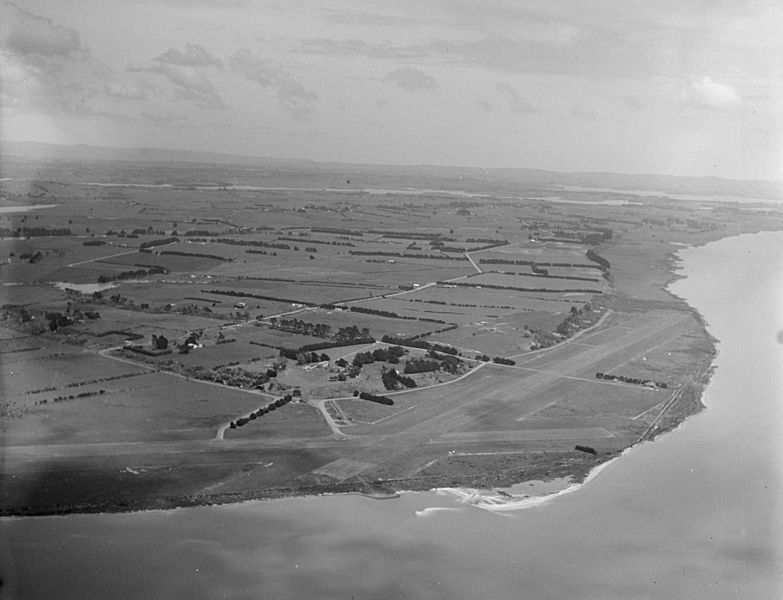
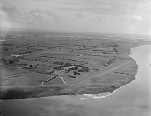
Image: Aerial view of Seagrove Aerodrome, Manukau Harbour, Auckland (1946) (cropped)

Description: Aerial view of Seagrove Aerodrome and surrounding countryside and coast, Manukau Harbour, Auckland. Photograph taken in 1946 by Whites Aviation. Seagrove Aerodrome was part of an RNZAF flying training station (RNZAF Station Seagrove) established during the Second world War. The station and runways were built in 1942 and operated as a training station from that year to 1944. Seagrove was also a base for the American Marine Corps from May to June 1943. After the war the site reverted to farmland. Quantity: 1 b&w original negative(s). Physical Description: Cellulosic film negative, 10.7 x 13 cm
Title: Aerial view of Seagrove Aerodrome, Manukau Harbour, Auckland (1946) (cropped)
Credit: https://natlib.govt.nz/records/23172927
Author: Whites Aviation Ltd
Usage Terms: Creative Commons Attribution 4.0
License: CC BY 4.0
License Link: https://creativecommons.org/licenses/by/4.0
Attribution Required?: Yes
Image usage
The following page links to this image:

_(cropped).jpg)