
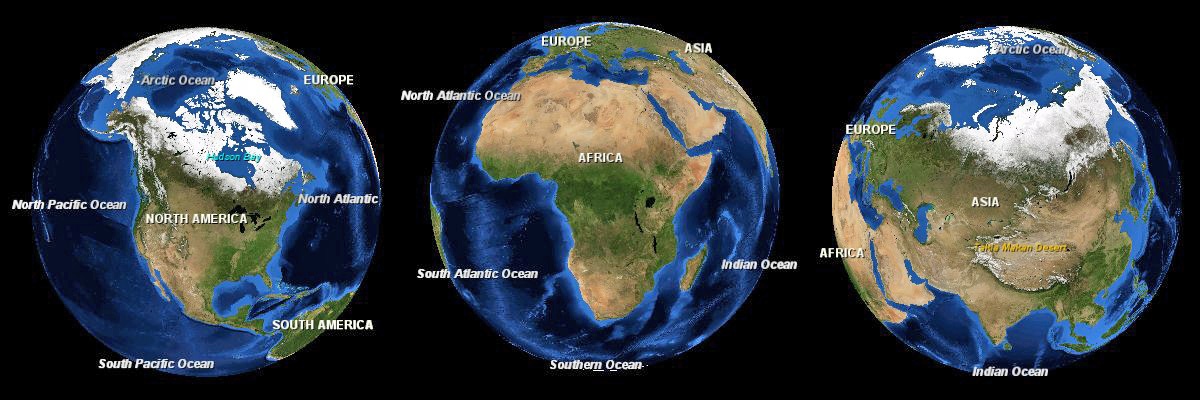
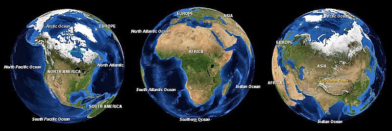
Image: Africa-asia-america-to-scale
Size of this preview: 800 × 267 pixels. Other resolutions: 320 × 107 pixels | 1,200 × 400 pixels.
Original image (1,200 × 400 pixels, file size: 223 KB, MIME type: image/jpeg)
Description: Three images of the Earth showing North America, Africa and Eurasia to scale.
Title: Africa-asia-america-to-scale
Credit: NASA World Wind
Author: Andrew Oakley
Permission: This image is in the public domain because it is a screenshot from NASA’s globe software World Wind using a public domain layer, such as Blue Marble, MODIS, Landsat, SRTM, USGS or GLOBE. English | فارسی | മലയാളം | Nederlands | Русский | +/−
Usage Terms: Public domain
License: Public domain
Attribution Required?: No
Image usage
There are no pages that link to this image.

All content from Kiddle encyclopedia articles (including the article images and facts) can be freely used under Attribution-ShareAlike license, unless stated otherwise.