
Image: AfricaMap2
Size of this preview: 800 × 307 pixels. Other resolutions: 320 × 123 pixels | 1,781 × 683 pixels.
Original image (1,781 × 683 pixels, file size: 225 KB, MIME type: image/jpeg)
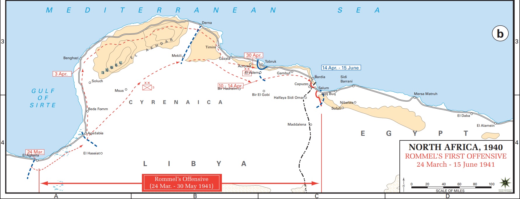
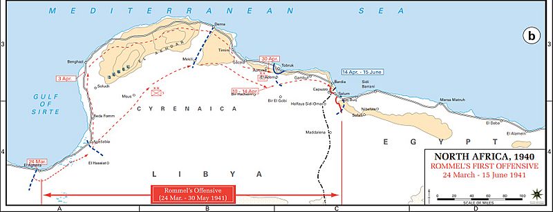
Description: Axis movements are depicted in red, and Allied positions are denoted by blue lines. Key dates are shown in boxes.
Title: AfricaMap2
Credit: Archive link to original website used for the map and the archive link to the map source page. Current link to map, and link to map source page.
Author: The History Department of the United States Military Academy
Permission: US Government document
Usage Terms: Public domain
License: Public domain
Attribution Required?: No
Image usage
The following 2 pages link to this image:

All content from Kiddle encyclopedia articles (including the article images and facts) can be freely used under Attribution-ShareAlike license, unless stated otherwise.