
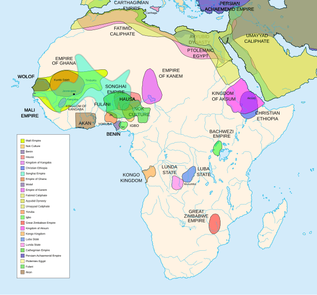
Image: African-civilizations-map-pre-colonial

Size of this PNG preview of this SVG file: 644 × 600 pixels. Other resolution: 258 × 240 pixels.
Original image (SVG file, nominally 1,390 × 1,295 pixels, file size: 487 KB)
Description: Africa History Atlas Diachronic map showing pre-colonial cultures of Africa (spanning roughly 500 BCE to 1500 CE) This map is "an artistic interpretation" using multiple and disparate sources.
Title: African-civilizations-map-pre-colonial
Credit: Own work
Author: Jeff Israel (ZyMOS)
Usage Terms: Creative Commons Attribution-Share Alike 3.0
License: CC BY-SA 3.0
License Link: http://creativecommons.org/licenses/by-sa/3.0
Attribution Required?: Yes
Image usage
The following 2 pages link to this image:

All content from Kiddle encyclopedia articles (including the article images and facts) can be freely used under Attribution-ShareAlike license, unless stated otherwise.