
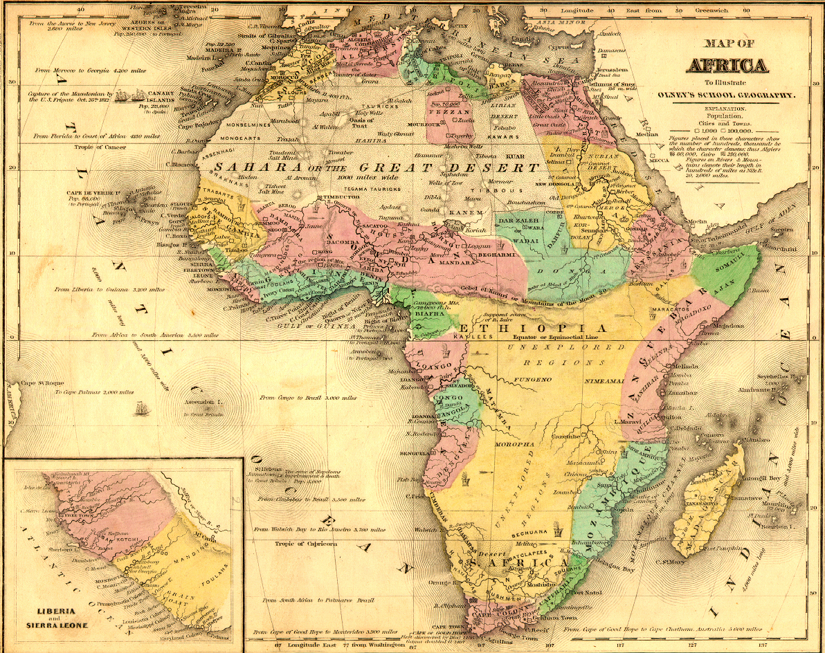
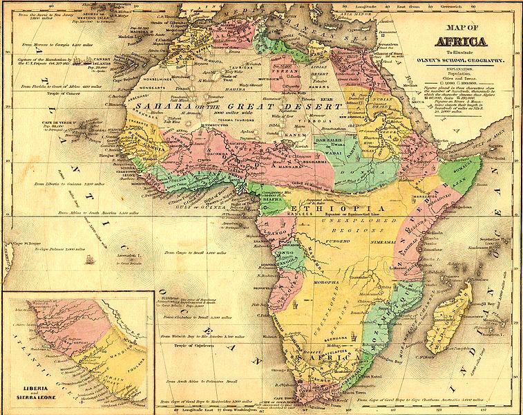
Image: African Map in 1840
Size of this preview: 757 × 600 pixels. Other resolutions: 303 × 240 pixels | 1,192 × 944 pixels.
Original image (1,192 × 944 pixels, file size: 1.87 MB, MIME type: image/jpeg)
Description: African Map before the 1884 Berlin Conference to divide Africa.
Title: African Map in 1840
Credit: Original publication: 1843 Immediate source: http://www.themapdatabase.com/1843/10/
Author: University of Florida Map and Imagery Library - Africa (Life time: 175)
Usage Terms: Public domain
License: Public domain
Attribution Required?: No
Image usage
The following 2 pages link to this image:

All content from Kiddle encyclopedia articles (including the article images and facts) can be freely used under Attribution-ShareAlike license, unless stated otherwise.