
Image: Alaska
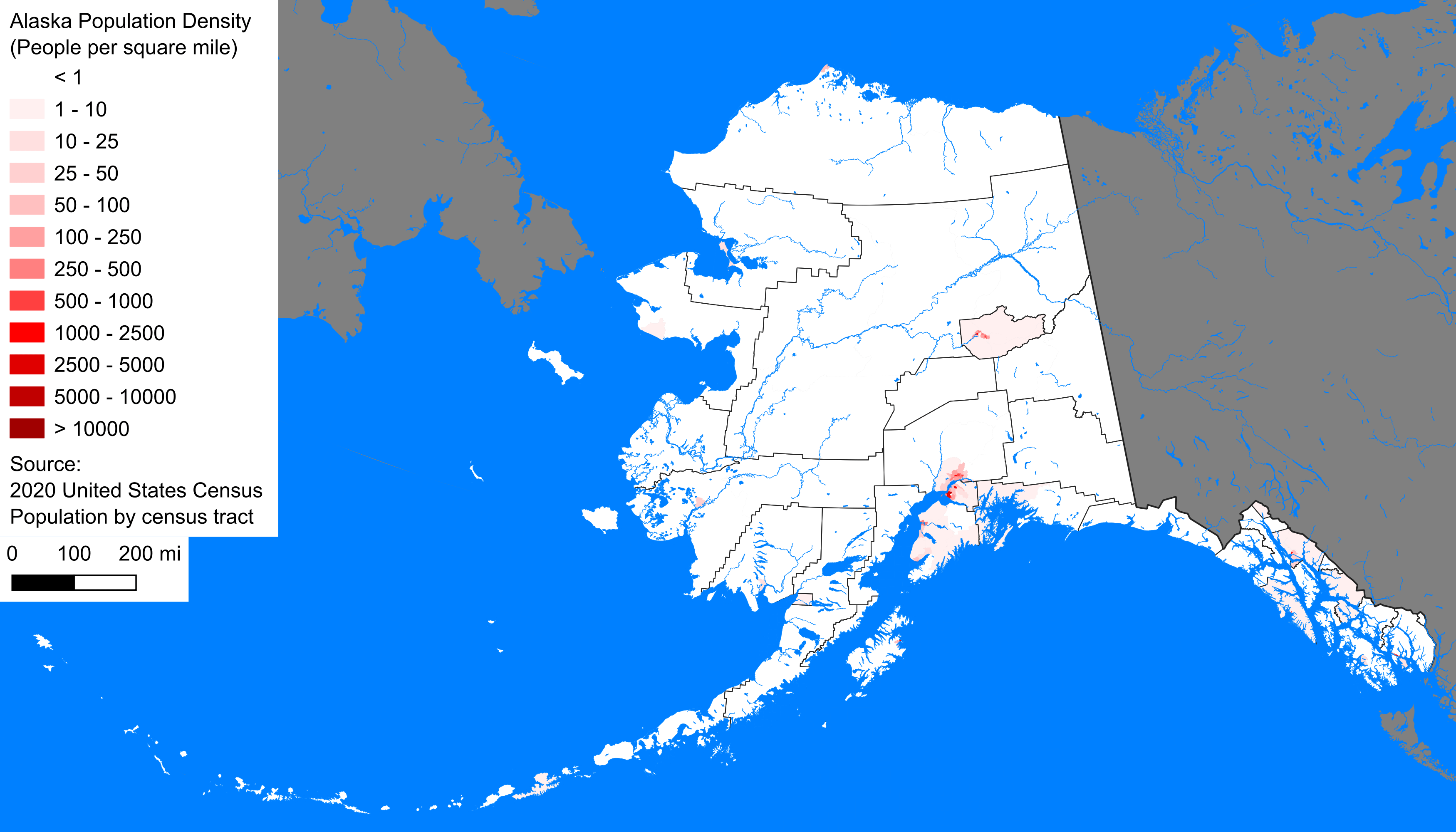
Description: Population density of Alaska by census tract as of the 2020 U.S. census. Map generation process described here. Note that this map uses an equal-area Albers projection, unlike the other maps in the series which use the Web Mercator projection. Because of the high latitude and large north-south span of Alaska, the Mercator projection would substantially distort areas resulting in northern Alaska appearing disproportionately large relative to southern Alaska.
Title: Alaska population density 2020
Credit: Own work
Author: Crossover1370
Usage Terms: Creative Commons Zero, Public Domain Dedication
License: CC0
License Link: http://creativecommons.org/publicdomain/zero/1.0/deed.en
Attribution Required?: No
Image usage
The following page links to this image:
