
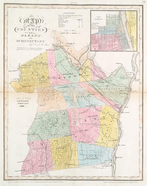
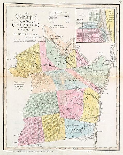
Image: AlbanyCounty1839
Size of this preview: 476 × 600 pixels. Other resolutions: 190 × 240 pixels | 603 × 760 pixels.
Original image (603 × 760 pixels, file size: 103 KB, MIME type: image/jpeg)
Description: Map of Albany and Schenectady counties in New York state from 1839
Title: AlbanyCounty1839
Credit: http://digitalgallery.nypl.org/nypldigital/dgkeysearchdetail.cfm?trg=1&strucID=253988&imageID=433787&total=220&num=20&word=albany&s=1¬word=&d=hm&c=&f=&k=0&lWord=&lField=&sScope=Library%20Division&sLevel=&sLabel=The%20Lionel%20Pincus%20and%20Princess%20Firyal%20Map%20Division&imgs=20&pos=38&e=w
Author: David H. Burr
Permission: Published in the USA prior to 1923
Usage Terms: Public domain
License: Public domain
Attribution Required?: No
Image usage
The following page links to this image:

All content from Kiddle encyclopedia articles (including the article images and facts) can be freely used under Attribution-ShareAlike license, unless stated otherwise.