
Image: Along the Shire Ditch to Broad Down - geograph.org.uk - 1417378
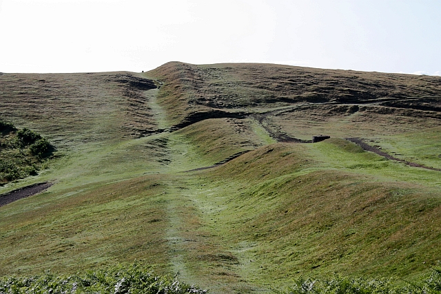
Description: Along the Shire Ditch to Broad Down Looking along the Red Earl's Dyke, defining the county boundary between Worcestershire and Herefordshire, towards Broad Down. Behind the camera is Millennium Hill, the southern peak of the iron-age hill fort of British Camp. Here in the "saddle" between the two hill tops the very popular path from the car park to Clutter's Cave crosses from left to right. A squat circular guide indicator (just to the right of the ditch) directs the visitor to the various routes to take. In the bottom of the ditch, on the skyline, one can see a boundary stone in silhouette.
Title: Along the Shire Ditch to Broad Down - geograph.org.uk - 1417378
Credit: From geograph.org.uk
Author: Bob Embleton
Usage Terms: Creative Commons Attribution-Share Alike 2.0
License: CC BY-SA 2.0
License Link: https://creativecommons.org/licenses/by-sa/2.0
Attribution Required?: Yes
Image usage
The following page links to this image:
