
Image: Alzate Plano de la Nueva Espana 1770 UTA
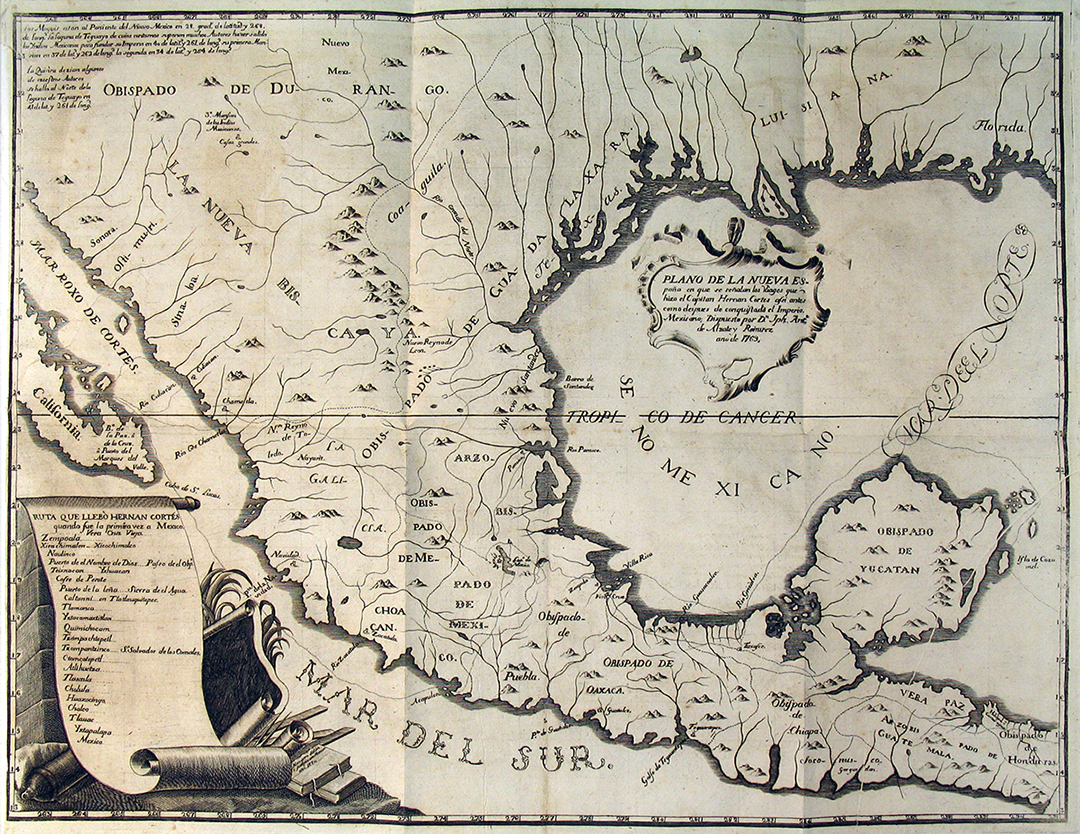
Description: Engraving by Juan Antonio Navarro. Mexico City Archbishop Francisco Antonio de Lorenzana (1722-1804), scientist and scholar Antonio Alzate y Ramirez (1739-1799), and engraver Juan Antonio Navarro (1742-ca.1809) worked in Mexico City to produce this map for a history of New Spain by the Archbishop. Working with Alzate's 1768 map of New Spain and texts of Cortes' second, third, and fourth letters, along with Lorenzana's commentaries and research, they traced Cortes' route of conquest past the island of Cozumel, around the Yucatan peninsula, to the Rio Grijalva, to Veracruz, and on to the City of Mexico. The road from Veracruz to Mexico City, long used by the Indians before Cortes, apparently became the foundation for Mexico's National Road. Many subsequent English and French writers used Lorenzana's presentation of Cortes' letters as primary sources for their own histories.
Title: Plano de la Nueva España: en que se señalan los viages que hizo el Capitan Hernan Cortes
Credit: UTA Libraries Cartographic Connections: map / text
Author: José Antonio de Alzate y Ramírez
Usage Terms: Public domain
License: Public domain
Attribution Required?: No
Image usage
The following page links to this image:
