
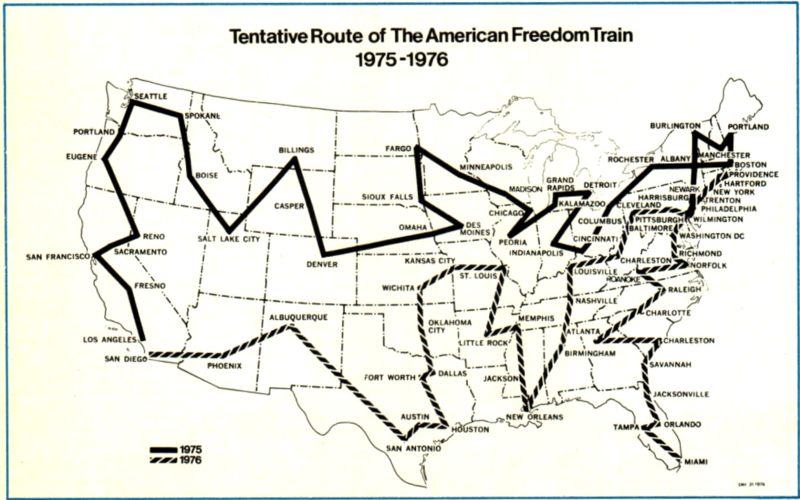
Image: American Freedom Train route map 1975

Size of this preview: 800 × 500 pixels. Other resolutions: 320 × 200 pixels | 1,413 × 884 pixels.
Original image (1,413 × 884 pixels, file size: 506 KB, MIME type: image/png)
Description: Tentative route of the "American Freedom Train" in 1975-1976.
Title: American Freedom Train route map 1975
Credit: U.S. Navy All Hands magazine June 1975, p. 57.
Author: U.S. Navy
Permission: "All photographs published in ALL HANDS are official Department of Defense photographs unless otherwise designated."
Usage Terms: Public domain
License: Public domain
Attribution Required?: No
Image usage
The following page links to this image:

All content from Kiddle encyclopedia articles (including the article images and facts) can be freely used under Attribution-ShareAlike license, unless stated otherwise.