
Image: Amtrak System Map

Size of this PNG preview of this SVG file: 800 × 501 pixels. Other resolution: 320 × 200 pixels.
Original image (SVG file, nominally 1,042 × 652 pixels, file size: 5.32 MB)
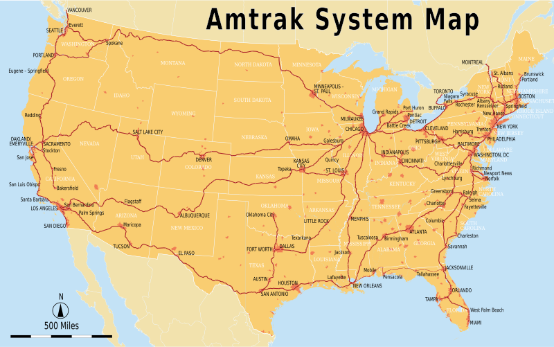
Description: Geographically accurate Amtrak system map with major stations marked. The Sunset Limited section between New Orleans and Orlando is currently suspended. This map is accurate up to the Norfolk and Brunswick extensions of late 2012.
Title: Amtrak System Map
Credit: Amtrak-Streckennetz.svg
Author: Amtrak-Streckennetz.svg: Maximilian Dörrbecker (Chumwa). Original uploader was Chumwa at de.wikipedia derivative work: Pi.1415926535 (talk)
Usage Terms: Creative Commons Attribution-Share Alike 2.5
License: CC BY-SA 2.5
License Link: https://creativecommons.org/licenses/by-sa/2.5
Attribution Required?: Yes
Image usage
The following page links to this image:

All content from Kiddle encyclopedia articles (including the article images and facts) can be freely used under Attribution-ShareAlike license, unless stated otherwise.