
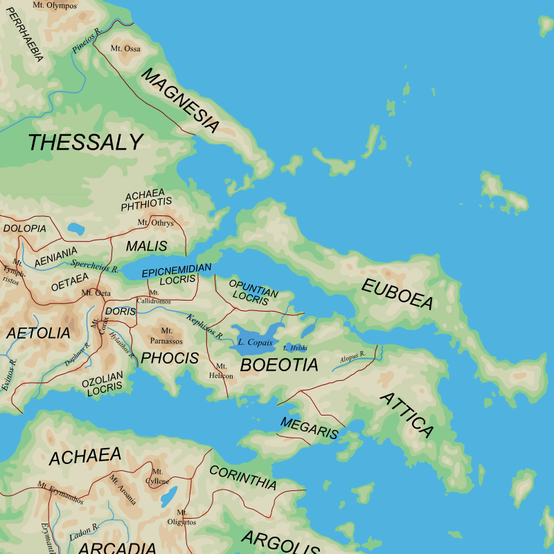
Image: Ancient Regions Central Greece
Description: Map of the central regions of Ancient Greece
Title: Ancient Regions Central Greece
Credit: blank(ish) map from Ancient_Greek_southern_regions.png, ultimately derived from Map_greek_sanctuaries-en.svg by Marsyas Geographical information based on public domain map of Greece, from the Perry-Castañeda Library Map Collection, Historical Atlas by William R. Shepherd north, south Most hydrological features are modern (and from the basemap). However, I have restored Lakes Copais and Hyliki, because these are essential to understanding ancient Boeotian geography. I have also restored the ancient shoreline of the Malian Gulf, which is essential for understanding the role of Thermopylae.
Author: User:MinisterForBadTimes
Usage Terms: Creative Commons Attribution-Share Alike 3.0
License: CC BY-SA 3.0
License Link: http://creativecommons.org/licenses/by-sa/3.0/
Attribution Required?: Yes
Image usage
The following page links to this image:
