
Image: AnnotatedGrandfatherFalls-ver02
Size of this preview: 593 × 600 pixels. Other resolutions: 237 × 240 pixels | 688 × 696 pixels.
Original image (688 × 696 pixels, file size: 1.07 MB, MIME type: image/png)
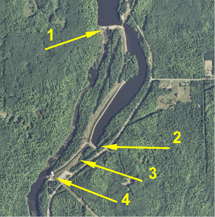
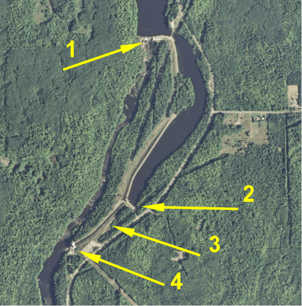
Description: Better version of annotated satellite view for article on Grandfather Falls. Background image source is USGS (federal government). Annotations are mine. Satellite view of Grandfather Falls hydro complex. 1: upper dam. 2: penstock intake. 3: penstocks. 4: power house. The distance from the upper dam to the power house is about 1 mile.
Title: AnnotatedGrandfatherFalls-ver02
Credit: Own work
Author: Jonwurl
Usage Terms: Creative Commons Attribution 3.0
License: CC BY 3.0
License Link: https://creativecommons.org/licenses/by/3.0
Attribution Required?: Yes
Image usage
The following page links to this image:

All content from Kiddle encyclopedia articles (including the article images and facts) can be freely used under Attribution-ShareAlike license, unless stated otherwise.